Navegação IPEN por Autores IPEN "LANDULFO, EDUARDO"
- Página inicial
- →
- IPEN
- →
- Navegação IPEN por Autores IPEN
- Sobre
- Perfil Técnico
- Política de funcionamento
- Ajuda
- Apresentação
Navegação IPEN por Autores IPEN "LANDULFO, EDUARDO"
Itens para a visualização no momento 1-20 de 174
-
CORDOBA-JABONERO, CARMEN; LORROZA, ELIANE G.; LANDULFO, EDUARDO
 ; NAKAEMA, WALTER M.
; CUEVAS, EMILIO; OCHOA, HECTOR; GIL-OJEDA, MANUEL. Active remote sensing observations for cirrus clouds profiling at subtropical and polar latitudes.
In: COMERON, ADOLFO (Ed.); KASSIANOV, EVGUENI I. (Ed.); SCHAFER, KLAUS (Ed.); PICARD, RICHARD H. (Ed.); STEIN, KARIN (Ed.); GONGLEWSKI, JOHN D. (Ed.) REMOTE SENSING OF CLOUDS AND THE ATMOSPHERE, 19TH; OPTICS IN ATMOSPHERRIC PROPAGATION AND ADAPTIVE SYSTEMS, 17th,
november 25, 2014,
Amsterdam, Netherlands.
Proceedings...
2014.
p. 9242203-1 - 9242203-10.
(SPIE Proceedings Series, 9242).
; NAKAEMA, WALTER M.
; CUEVAS, EMILIO; OCHOA, HECTOR; GIL-OJEDA, MANUEL. Active remote sensing observations for cirrus clouds profiling at subtropical and polar latitudes.
In: COMERON, ADOLFO (Ed.); KASSIANOV, EVGUENI I. (Ed.); SCHAFER, KLAUS (Ed.); PICARD, RICHARD H. (Ed.); STEIN, KARIN (Ed.); GONGLEWSKI, JOHN D. (Ed.) REMOTE SENSING OF CLOUDS AND THE ATMOSPHERE, 19TH; OPTICS IN ATMOSPHERRIC PROPAGATION AND ADAPTIVE SYSTEMS, 17th,
november 25, 2014,
Amsterdam, Netherlands.
Proceedings...
2014.
p. 9242203-1 - 9242203-10.
(SPIE Proceedings Series, 9242).
Palavras-Chave: clouds; optical radar; physical properties; polar regions; tropical regions; meteorology
. Active remote sensing observations for cirrus clouds profiling at subtropical and polar latitudes. In: COMERON, ADOLFO (ed.); KASSIANOV, EVGUENI I. (ed.); SCHAFER, KLAUS (ed.); PICARD, RICHARD H. (ed.); STEIN, KARIN (ed.); GONGLEWSKI, JOHN D. (ed.) REMOTE SENSING OF CLOUDS AND THE ATMOSPHERE, 19TH; OPTICS IN ATMOSPHERRIC PROPAGATION AND ADAPTIVE SYSTEMS, 17th, november 25, 2014, Amsterdam, Netherlands. Proceedings... 2014. p. 9242203-1 - 9242203-10. (SPIE Proceedings Series, 9242). Disponível em: http://repositorio.ipen.br/handle/123456789/23400. Acesso em: $DATA.Como referenciar este itemEsta referência é gerada automaticamente de acordo com as normas do estilo IPEN/SP (ABNT NBR 6023) e recomenda-se uma verificação final e ajustes caso necessário.

-
LANDULFO, EDUARDO
; LOPES, FABIO J.S.; GUERRERO RASCADO, JUAN L.; ALADOS ARBOLEDAS, LUCAS. Aerosol cloud interaction: a multiplataform-scenario-based methodology.
In: SINGH, UPENDRA N. (Ed.); NICOLAE, DOINA N. (Ed.) LIDAR TECHNOLOGIES, TECHNIQUES AND MEASUREMENTS FOR ATMOSPHERIC REMOTE SENSING, 11th,
November 4, 2015,
Proceedings...
Society of Photho-optical Instrumentation Engineers,
2015.
p. 96450N-1 - 96450N-10.
(SPIE Proceedings Series, 9645).
Palavras-Chave: aerosols; clouds; particles; satellite atmospheres; photometry; optical radar
. Aerosol cloud interaction: a multiplataform-scenario-based methodology. In: SINGH, UPENDRA N. (ed.); NICOLAE, DOINA N. (ed.) LIDAR TECHNOLOGIES, TECHNIQUES AND MEASUREMENTS FOR ATMOSPHERIC REMOTE SENSING, 11th, November 4, 2015, Proceedings... Society of Photho-optical Instrumentation Engineers, 2015. p. 96450N-1 - 96450N-10. (SPIE Proceedings Series, 9645). Disponível em: http://repositorio.ipen.br/handle/123456789/25502. Acesso em: $DATA.Como referenciar este itemEsta referência é gerada automaticamente de acordo com as normas do estilo IPEN/SP (ABNT NBR 6023) e recomenda-se uma verificação final e ajustes caso necessário.
-
LOPES, FABIO J.S.
; GUERRERO-RASCADO, JUAN L.; LANDULFO, EDUARDO
; KROTKOV, NICKOLAY; HUGHES, ERIC; SILVA, ARLINDO da. Aerosol layer observation of 2015 Calbuco volcanic eruption over the LALINET São Paulo station.
In: WORKSHOP ON LIDAR MEASUREMENTS IN LATIN AMERICA, 9th,
July 17-22, 2016,
Santos, SP.
Abstract...
2016.
Abstract:
On the 22nd of April 2015, the Calbuco volcano sited at the South region of Chile had its first eruption since 1972, injecting a huge plume of volcanic aerosol particles and gases up to 21 km into the atmosphere. As part of the Latin America Lidar Network’s (LALINET) aim to monitor any atmospheric event the LALINET São Paulo station (SPU) started continuous observation in order to monitor the dispersion of volcanic aerosol layer and their altitude and optical properties. After 5 days, on 27 April 2015, some volcanic plumes arrived over the Metropolitan area of São Paulo (MASP) and were detected by the SPU system within the altitude range of 18-19 km. The timing and altitude of SPU observations coincide with transport and dispersion simulations of the volcanic cloud’s arrival at São Paulo, from the Goddard Earth Observing System Model, version 5 (GEOS-5) and Goddard Chemistry Aerosol Radiation and Transport (GOCART) model from NASA Goddard Space Flight Center. The models simulate the volcanic eruption’s injection of SO2, SO4, and ash into the atmosphere and the advection of the volcanic plume away from the volcano. The purpose of this study is to determine the optical properties of the volcanic plume such as AOD and Lidar ratio. Applying the transmittance method used previously for cirrus clouds it was possible to retrieve the AOD value of 0.16 ± 0.21 and a lidar ratio of 64 ± 4 sr.
. Aerosol layer observation of 2015 Calbuco volcanic eruption over the LALINET São Paulo station. In: WORKSHOP ON LIDAR MEASUREMENTS IN LATIN AMERICA, 9th, July 17-22, 2016, Santos, SP. Abstract... 2016. Disponível em: http://repositorio.ipen.br/handle/123456789/27992. Acesso em: $DATA.Como referenciar este item
Esta referência é gerada automaticamente de acordo com as normas do estilo IPEN/SP (ABNT NBR 6023) e recomenda-se uma verificação final e ajustes caso necessário.
-
OLIVEIRA, DANIEL C.F. dos S.; HOELZEMANN, JUDITH J.; LANDULFO, EDUARDO
; ALADOS-ARBOLEDAS, LUCAS; GUERRERO-RASCADO, JUAN L.. Aerosol optical properties in the atmosphere of Natal/Brazil by an AERONET network Sun-photometer.
In: ALBUQUERQUE, TACIANA T.A. (Ed.); ANDRADE, MARIA DE F. (Ed.); SANTOS, JANE M. (Ed.) AIR POLLUTION CONFERENCE BRAZIL; COMMUNITY MODELING AND ANALYSIS SYSTEM SOUTH AMERICA, 4th,
July 22-24, 2019,
Belo Horizonte, MG.
Proceedings...
Belo Horizonte, MG: SEAD, Treinamentos e Coaching,
2019.
p. 319-324.
Abstract:
The study of atmospheric aerosols contributes to the understanding of radiative forcing and global warming. In
addition, aerosols may influence atmospheric chemistry, visibility, precipitation and human health. Since 2016, Natal (capital
of Rio Grande do Norte, Brazil) has a Sun-photometer (CIMEL) of the RIMA-AERONET network that can identify the presence of
biomass burning aerosols and desert dust from Africa. For this identification, it is aimed to characterize the optical properties
of these aerosols present in the atmosphere of Natal. The level 1.5 data (version 3) provided by AERONET provide information
on some aerosol characteristics such as Aerosol Optical Depth (AOD), Ångström Exponent (α), Single Scattering Albedo (SSA),
Asymmetry Factor (g), Complex Refractive Index (N) and Volume Size Distribution (VSD). The analysis period was from August
2017 to March 2018. Aerosols were classified according to global climatologies and their optical properties were described. In
addition, backward trajectories were modeled using the HYSPLIT model (version 4.8) to identify the predominant air masses
origins. Aerosols present in the atmospheric column of Natal showed monthly mean AOD (500 nm)in the range of 0.10 to
0.(representing ~40%), monthly means of α (440-670 nm)between 0.6 and 0.8 (representing 30%), bimodal VSD with dominant
coarse mode, SSA (440 nm) about 0.80, real part around 1.500, imaginary part ranging from 0.0125 to 0.0437 and g above 0.74.
The classification showed mixed (60.4%), marine (30.7%) and mineral dust (8.9%) aerosols. The backward trajectories identified
that, in about 51% of the cases, are originated from Africa.
Palavras-Chave: satellite atmospheres; photometers; optical radar; atmospheres; optical properties; dusts; environment; environmental impacts; biomass; climatic change
. Aerosol optical properties in the atmosphere of Natal/Brazil by an AERONET network Sun-photometer. In: ALBUQUERQUE, TACIANA T.A. (ed.); ANDRADE, MARIA DE F. (ed.); SANTOS, JANE M. (ed.) AIR POLLUTION CONFERENCE BRAZIL; COMMUNITY MODELING AND ANALYSIS SYSTEM SOUTH AMERICA, 4th, July 22-24, 2019, Belo Horizonte, MG. Proceedings... Belo Horizonte, MG: SEAD, Treinamentos e Coaching, 2019. p. 319-324. Disponível em: http://repositorio.ipen.br/handle/123456789/31280. Acesso em: $DATA.Como referenciar este itemEsta referência é gerada automaticamente de acordo com as normas do estilo IPEN/SP (ABNT NBR 6023) e recomenda-se uma verificação final e ajustes caso necessário.
-
OLIVEIRA, DANIEL C.F. dos S.; MONTILLA-ROSERO, ELENA; LOPES, FABIO J. da S.
; MORAIS, FERNANDO G.
; LANDULFO, EDUARDO
; HOELZEMANN, JUDITH J.. Aerosol properties in the atmosphere of Natal/Brazil measured by an AERONET Sun-photometer.
Environmental Science and Pollution Research,
v. 28,
n. 8,
p. 9806-9823,
2021.
DOI:
10.1007/s11356-020-11373-z
Abstract:
We analyzed data measured by a Sun-photometer of the RIMA-AERONET network with the purpose to characterize the aerosol properties in the atmosphere over Natal, state capital of Rio Grande do Norte, at the coast of Northeast Brazil. Aerosol Optical Depth, Ångström Exponent, Volume Size Distribution, Single Scattering Albedo, Complex Refractive Index, Asymmetry Factor, and Precipitable Water were analyzed from August 2017 to March 2018. In addition, MODIS and CALIOP observations, local Lidar measurements, and modeled backward trajectories were analyzed in a case study on February 9, 2018, that consistently confirmed the identification of a persistent aerosol layer below 4 km agl. Aerosols present in the atmosphere of Natal showed monthly mean Aerosol Optical Depth at 500 nm below 0.15 (~ 75%), monthly means of the Ångström Exponent at 440–670 nm between 0.30 and 0.70 (~ 69%), bimodal Volume Size Distribution is dominantly coarse mode, Single Scattering Albedo at 440 nm is 0.80, Refractive Index - Real Part around 1.50, Refractive Index - Imaginary Part ranging from 0.01 to 0.04, and the Asymmetry Factor ranged from 0.73 to 0.80. The aerosol typing during the measurement period showed that atmospheric aerosol over Natal is mostly composed of mixed aerosol (58.10%), marine aerosol (34.80%), mineral dust (6.30%), and biomass burning aerosols (0.80%). Backward trajectories identified that 51% of the analyzed air masses over Natal originated from the African continent.
Palavras-Chave: satellite atmospheres; sun; photometers; optical radar; optical systems; aerial monitoring; atmospheres; optical properties; dusts; environment; environmental impacts; physical properties; biomass; brazil; africa; climatic change
. Aerosol properties in the atmosphere of Natal/Brazil measured by an AERONET Sun-photometer. Environmental Science and Pollution Research, v. 28, n. 8, p. 9806-9823, 2021. DOI: 10.1007/s11356-020-11373-z. Disponível em: http://repositorio.ipen.br/handle/123456789/31933. Acesso em: $DATA.Como referenciar este itemEsta referência é gerada automaticamente de acordo com as normas do estilo IPEN/SP (ABNT NBR 6023) e recomenda-se uma verificação final e ajustes caso necessário.
-
MARIANO, GLAUBER L.; LOPES, FABIO J.; STEFFENS, JULIANA; MARTIN, MARIA P.P.; LANDULFO, EDUARDO
; HELD, GERHARD; ANJOS, SERGIO dos. Aerosols monitoring in Rio Claro, Brazil: using lidar and air pollution analyzers.
Optica Pura y Aplicada,
v. 44,
n. 1,
p. 55-64,
2011.
Palavras-Chave: brazil; biomass plantations; burns; aerosol monitoring; radar
. Aerosols monitoring in Rio Claro, Brazil: using lidar and air pollution analyzers. Optica Pura y Aplicada, v. 44, n. 1, p. 55-64, 2011. Disponível em: http://repositorio.ipen.br/handle/123456789/4374. Acesso em: $DATA.Como referenciar este itemEsta referência é gerada automaticamente de acordo com as normas do estilo IPEN/SP (ABNT NBR 6023) e recomenda-se uma verificação final e ajustes caso necessário.
-
LANDULFO, EDUARDO
; LOPES, FABIO J. da S.; NAKAEMA, WALTER M.; LARROZA, ELIANE G.; ARAUJO, FELIPE V.; RODRIGUES, PATRICIA F.; RISTORI, PABLO; OTERO, LIDIA; PALLOTTA, JUAN; PAWELKO, EZEQUIEL; CHOUZA, FERNANDO; QUEL, EDUARDO; FORNO, R.; SANCHEZ, MARIA F.; CALDERON, FERNANDO; BARBOSA, HENRIQUE; GOUVEIA, DIEGO A.; ARTAXO, PAULO; MONTILLA, E.; SILVA, ANTONIETA; JIMENEZ, C.; SAAVEDRA, CALOS; HERNANDEZ, ROLANDO; ARREDONDO, RENE E.; GONZALEZ, BORIS B.; BRUNETA, CARLOS E.H.; SANCHEZ, JUAN C.A.; MARRERO, JUAN C.A.; GUSTIN, ALVARO B.; TOLEDO, DANIEL N.; BEDOYA, ANDRES; ALEGRIA, DAIRO; MUNERA, MAURICIO; WHITEMAN, DAVID. ALINE network status.
In: WORKSHOP ON LIDAR MEASUREMENTS IN LATIN AMERICA, 7th,
November 11-16, 2013,
Pucón, Chile.
Abstract...
2013.
p. 56.
Palavras-Chave: optical radar; computer networks; aerosol monitoring; climatic change; biomass; fires; seasonal variations; volcanic regions; latin america
. ALINE network status. In: WORKSHOP ON LIDAR MEASUREMENTS IN LATIN AMERICA, 7th, November 11-16, 2013, Pucón, Chile. Abstract... 2013. p. 56. Disponível em: http://repositorio.ipen.br/handle/123456789/20253. Acesso em: $DATA.Como referenciar este itemEsta referência é gerada automaticamente de acordo com as normas do estilo IPEN/SP (ABNT NBR 6023) e recomenda-se uma verificação final e ajustes caso necessário.
-
LANDULFO, EDUARDO
; LOPES, FABIO J. da S.
; MOREIRA, GREGORI de A.
; MARQUES, MARCIA T.A.
; OSNEIDE, MARCELO
; ANTUNA, JUAN C.; ARREDONDO, RENE E.; RASCADO, JUAN L.G.; ALADOS ARBOLEDAS, LUCAS; BASTIDAS, ALVARO; NISPERUZA, DANIEL; BEDOYA, ANDRES; MUNERA, MAURICIO; ALEGRIA, DAIRO; FORNO, RICARDO N.; SANCHEZ, MARIA F.; LAZCANO, OSCAR; MONTILLA ROSERO, ELENA; SILVA, ANTONIETA; JIMENEZ, CRISTOFER; QUEL, EDUARDO; RISTORI, PABLO; OTERO, LIDIA; BARBOSA, HENRIQUE M.J.; GOUVEIA, DIEGO A.; BARJA, BORIS. ALINE/LALINET network status.
EPJ Web of Conferences,
v. 119,
2016.
Palavras-Chave: computer networks; optical radar; inventories; monitoring; optical properties; distribution
. ALINE/LALINET network status. EPJ Web of Conferences, v. 119, 2016. Disponível em: http://repositorio.ipen.br/handle/123456789/26547. Acesso em: $DATA.Como referenciar este itemEsta referência é gerada automaticamente de acordo com as normas do estilo IPEN/SP (ABNT NBR 6023) e recomenda-se uma verificação final e ajustes caso necessário.
-
OLIVEIRA, ALINE M. de; SOUZA, CRISTINA T.; OLIVEIRA, NARA P.M. de; MELO, ALINE K.S.; LOPES, FABIO J.S.
; LANDULFO, EDUARDO
; ELBERN, HENDRIK; HOELZEMANN, JUDITH J.. Analysis of atmospheric aerosol optical properties in the northeast Brazilian atmosphere with remote sensing data from MODIS and CALIOP/CALIPSO satellites, AERONET photometers and a ground-based Lidar.
Atmosphere,
v. 10,
n. 10,
p. 1-22,
2019.
DOI:
10.3390/atmos10100594
Abstract:
A 12-year analysis, from 2005 to 2016, of atmospheric aerosol optical properties focusing
for the first time on Northeast Brazil (NEB) was performed based on four di erent remote sensing
datasets: the Moderate Resolution Imaging Spectroradiometer (MODIS), the Aerosol Robotic Network
(AERONET), the Cloud-Aerosol LIDAR with Orthogonal Polarization (CALIOP) and a ground-based
Lidar from Natal. We evaluated and identified distinct aerosol types, considering Aerosol Optical
Depth (AOD) and Angström Exponent (AE). All analyses show that over the NEB, a low aerosol
scenario prevails, while there are two distinct seasons of more elevated AOD that occur every year,
from August to October and January to March. According to MODIS, AOD values ranges from 0.04 to
0.52 over the region with a mean of 0.20 and occasionally isolated outliers of up to 1.21. Aerosol types
were identified as sea spray, biomass burning, and dust aerosols mostly transported from tropical
Africa. Three case studies on days with elevated AOD were performed. All cases identified the
same aerosol types and modeled HYSPLIT backward trajectories confirmed their source-dependent
origins. This analysis is motivated by the implementation of an atmospheric chemistry model with an
advanced data assimilation system that will use the observational database over NEB with the model
to overcome high uncertainties in the model results induced by still unvalidated emission inventories.
Palavras-Chave: aerosols; aerosol monitoring; optical radar; dusts; datasets; satellites; atmospherics; meteorology; optical properties; brazil; atmospheric circulation
. Analysis of atmospheric aerosol optical properties in the northeast Brazilian atmosphere with remote sensing data from MODIS and CALIOP/CALIPSO satellites, AERONET photometers and a ground-based Lidar. Atmosphere, v. 10, n. 10, p. 1-22, 2019. DOI: 10.3390/atmos10100594. Disponível em: http://repositorio.ipen.br/handle/123456789/30378. Acesso em: $DATA.Como referenciar este itemEsta referência é gerada automaticamente de acordo com as normas do estilo IPEN/SP (ABNT NBR 6023) e recomenda-se uma verificação final e ajustes caso necessário.
-
MOREIRA, GREGORI de A.
; LOPES, FABIO J. da S.
; GUERRERO-RASCADO, JUAN L.; SILVA, JONATAN J. da
; GOMES, ANTONIO A.
; LANDULFO, EDUARDO
; ALADOS-ARBOLEDAS, LUCAS. Analyzing the atmospheric boundary layer using high-order moments obtained from multiwavelength lidar data: impact of wavelength choice.
Atmospheric Measurement Techniques,
v. 12,
n. 8,
p. 4261-4276,
2019.
DOI:
10.5194/amt-12-4261-2019
Abstract:
The lowest region of the troposphere is a turbulent
layer known as the atmospheric boundary layer (ABL)
and characterized by high daily variability due to the influence
of surface forcings. This is the reason why detecting
systems with high spatial and temporal resolution, such as
lidar, have been widely applied for researching this region.
In this paper, we present a comparative analysis on the use
of lidar-backscattered signals at three wavelengths (355, 532
and 1064 nm) to study the ABL by investigating the highorder
moments, which give us information about the ABL
height (derived by the variance method), aerosol layer movement
(skewness) and mixing conditions (kurtosis) at several
heights. Previous studies have shown that the 1064 nm wavelength,
due to the predominance of particle signature in the
total backscattered atmospheric signal and practically null
presence of molecular signal (which can represent noise in
high-order moments), provides an appropriate description of
the turbulence field, and thus in this study it was considered
a reference. We analyze two case studies that show us that
the backscattered signal at 355 nm, even after applying some
corrections, has a limited applicability for turbulence studies
using the proposed methodology due to the strong contribution
of the molecular signature to the total backscatter signal.
This increases the noise associated with the high-order
profiles and, consequently, generates misinformation. On the
other hand, the information on the turbulence field derived
from the backscattered signal at 532 nm is similar to that obtained at 1064 nm due to the appropriate attenuation of the
noise, generated by molecular component of backscattered
signal by the application of the corrections proposed.
Palavras-Chave: troposphere; optical radar; boundary layers; atmospheres; aerosols; turbulence; air quality; monitoring
. Analyzing the atmospheric boundary layer using high-order moments obtained from multiwavelength lidar data: impact of wavelength choice. Atmospheric Measurement Techniques, v. 12, n. 8, p. 4261-4276, 2019. DOI: 10.5194/amt-12-4261-2019. Disponível em: http://repositorio.ipen.br/handle/123456789/30379. Acesso em: $DATA.Como referenciar este itemEsta referência é gerada automaticamente de acordo com as normas do estilo IPEN/SP (ABNT NBR 6023) e recomenda-se uma verificação final e ajustes caso necessário.
-
MOREIRA, GREGORI de A.
; CACHEFFO, ALEXANDRE
; ANDRADE, IZABEL da S.
; LOPES, FABIO JULIANO da S.
; GOMES, ANTONIO A.
; LANDULFO, EDUARDO
. Analyzing the influence of vehicular traffic on the concentration of pollutants in the city of São Paulo: an approach based on pandemic SARS-CoV-2 data and deep learning.
Atmosphere,
v. 14,
n. 10,
p. 1-16,
2023.
DOI:
10.3390/atmos14101578
Abstract:
This study employs surface and remote sensing data jointly with deep learning techniques
to examine the influence of vehicular traffic in the seasonal patterns of CO, NO2
, PM2.5, and PM10
concentrations in the São Paulo municipality, as the period of physical distancing (March 2020 to
December 2021), due to SARS-CoV-2 pandemic and the resumption of activities, made it possible to
observe significant variations in the flow of vehicles in the city of São Paulo. Firstly, an analysis of the
planetary boundary layer height and ventilation coefficient was performed to identify the seasons’
patterns of pollution dispersion. Then, the variations (from 2018 to 2021) of the seasonal average
values of air temperature, relative humidity, precipitation, and thermal inversion occurrence/position
were compared to identify possible variations in the patterns of such variables that would justify (or
deny) the occurrence of more favorable conditions for pollutants dispersion. However, no significant
variations were found. Finally, the seasonal average concentrations of the previously mentioned
pollutants were compared from 2018 to 2021, and the daily concentrations observed during the
pandemic period were compared with a model based on an artificial neural network. Regarding the
concentration of pollutants, the primarily sourced from vehicular traffic (CO and NO2
) exhibited
substantial variations, demonstrating an inverse relationship with the rate of social distancing.
In addition, the measured concentrations deviated from the predictive model during periods of
significant social isolation. Conversely, pollutants that were not primarily linked to vehicular sources
(PM2.5 and PM10) exhibited minimal variation from 2018 to 2021; thus, their measured concentration
remained consistent with the prediction model.
Palavras-Chave: urban areas; air pollution; air quality; machine learning; vehicles; coronaviruses
. Analyzing the influence of vehicular traffic on the concentration of pollutants in the city of São Paulo: an approach based on pandemic SARS-CoV-2 data and deep learning. Atmosphere, v. 14, n. 10, p. 1-16, 2023. DOI: 10.3390/atmos14101578. Disponível em: http://repositorio.ipen.br/handle/123456789/34210. Acesso em: $DATA.Como referenciar este itemEsta referência é gerada automaticamente de acordo com as normas do estilo IPEN/SP (ABNT NBR 6023) e recomenda-se uma verificação final e ajustes caso necessário.
-
MOREIRA, GREGORI de A.
; GUERRERO-RASCADO, JUAN L.; BENAVENT-OLTRA, JOSE A.; ORTIZ-AMEZCUA, PABLO; ROMAN, ROBERTO; BEDOYA-VELASQUEZ, ANDRES E.; BRAVO-ARANDA, JUAN A.; REYES, FRANCISCO J.O.; LANDULFO, EDUARDO
; ALADOS-ARBOLEDAS, LUCAS. Analyzing the turbulent planetary boundary layer by remote sensing systems: the Doppler wind lidar, aerosol elastic lidar and microwave radiometer.
Atmospheric Chemistry and Physics,
v. 19,
n. 2,
p. 1263-1280,
2019.
DOI:
10.5194/acp-19-1263-2019
Abstract:
The planetary boundary layer (PBL) is the lowermost
region of troposphere and is endowed with turbulent
characteristics, which can have mechanical and/or thermodynamic
origins. This behavior gives this layer great importance,
mainly in studies about pollutant dispersion and
weather forecasting. However, the instruments usually applied
in studies of turbulence in the PBL have limitations
in spatial resolution (anemometer towers) or temporal resolution
(instrumentation aboard an aircraft). Ground-based
remote sensing, both active and passive, offers an alternative
for studying the PBL. In this study we show the capabilities
of combining different remote sensing systems (microwave
radiometer – MWR, Doppler lidar – DL – and elastic lidar
– EL) for retrieving a detailed picture on the PBL turbulent
features. The statistical moments of the high frequency distributions
of the vertical wind velocity, derived from DL,
and of the backscattered coefficient, derived from EL, are
corrected by two methodologies, namely first lag correction
and 2=3 law correction. The corrected profiles, obtained
from DL data, present small differences when compared with
the uncorrected profiles, showing the low influence of noise
and the viability of the proposed methodology. Concerning
EL, in addition to analyzing the influence of noise, we explore
the use of different wavelengths that usually include
EL systems operated in extended networks, like the European
Aerosol Research Lidar Network (EARLINET), Latin American
Lidar Network (LALINET), NASA Micro-Pulse Lidar
Network (MPLNET) or Skyradiometer Network (SKYNET).
In this way we want to show the feasibility of extending the
capability of existing monitoring networks without strong investments
or changes in their measurements protocols. Two
case studies were analyzed in detail, one corresponding to
a well-defined PBL and another corresponding to a situation
with presence of a Saharan dust lofted aerosol layer
and clouds. In both cases we discuss results provided by the
different instruments showing their complementarity and the
precautions to be applied in the data interpretation. Our study
shows that the use of EL at 532 nm requires a careful correction
of the signal using the first lag time correction in order
to get reliable turbulence information on the PBL.
Palavras-Chave: boundary layers; troposphere; planetary atmospheres; doppler effect; wind; optical radar; monitoring; microwave radiation; radiometers; aerosols; elastic scattering; remote sensing
. Analyzing the turbulent planetary boundary layer by remote sensing systems: the Doppler wind lidar, aerosol elastic lidar and microwave radiometer. Atmospheric Chemistry and Physics, v. 19, n. 2, p. 1263-1280, 2019. DOI: 10.5194/acp-19-1263-2019. Disponível em: http://repositorio.ipen.br/handle/123456789/29929. Acesso em: $DATA.Como referenciar este itemEsta referência é gerada automaticamente de acordo com as normas do estilo IPEN/SP (ABNT NBR 6023) e recomenda-se uma verificação final e ajustes caso necessário.
-
GOUVEIA, DIEGO; BAARS, HOLGER; SEIFERT, PATRIC; WANDINGER, ULLA; BARBOSA, HENRIQUE; BARJA, BORIS; ARTAXO, PAULO; LOPES, FABIO
; LANDULFO, EDUARDO
; ANSMANN, ALBERT. Application of a multiple scattering model to estimate optical depth, lidar ratio and ice crystal effective radius of cirrus clouds observed with lidar.
EPJ Web of Conferences,
v. 176,
n. 05037,
p. 1-4,
2018.
DOI:
10.1051/epjconf/201817605037
Abstract:
Lidar measurements of cirrus clouds are highly influenced by multiple scattering (MS). We therefore developed an iterative approach to correct elastic backscatter lidar signals for multiple scattering to obtain best estimates of single-scattering cloud optical depth and lidar ratio as well as of the ice crystal effective radius. The approach is based on the exploration of the effect of MS on the molecular backscatter signal returned from above cloud top.
Palavras-Chave: multiple scattering; optical radar; crystals; clouds; optical depth curve; elastic scattering; photons
. Application of a multiple scattering model to estimate optical depth, lidar ratio and ice crystal effective radius of cirrus clouds observed with lidar. EPJ Web of Conferences, v. 176, n. 05037, p. 1-4, 2018. DOI: 10.1051/epjconf/201817605037. Disponível em: http://repositorio.ipen.br/handle/123456789/28952. Acesso em: $DATA.Como referenciar este itemEsta referência é gerada automaticamente de acordo com as normas do estilo IPEN/SP (ABNT NBR 6023) e recomenda-se uma verificação final e ajustes caso necessário.
-
STEFFENS, JULIANA; LANDULFO, EDUARDO
; COURROL, LILIA C.
; GUARDANI, ROBERTO. Application of fluorescence to the study of crude petroleum.
Journal of Fluorescence,
v. 21,
n. 3,
p. 859-864,
2011.
Palavras-Chave: petroleum; fluorescence; emission spectroscopy; oils
. Application of fluorescence to the study of crude petroleum. Journal of Fluorescence, v. 21, n. 3, p. 859-864, 2011. Disponível em: http://repositorio.ipen.br/handle/123456789/4519. Acesso em: $DATA.Como referenciar este itemEsta referência é gerada automaticamente de acordo com as normas do estilo IPEN/SP (ABNT NBR 6023) e recomenda-se uma verificação final e ajustes caso necessário.
-
AMARAL, MARCELLO M.
; RAELE, MARCUS P.
; LANDULFO, EDUARDO
; VIEIRA JUNIOR, NILSON D.
; FREITAS, ANDERSON Z. de
. Application of LIDAR-like equations to OCT signal analysis for total extinction coefficient determination.
In: ENCONTRO NACIONAL DE FISICA DA MATERIA CONDENSADA, 33.,
10-14 de maio, 2010,
Aguas de Lindoia, SP.
Resumos...
2010.
Palavras-Chave: tomography; optical properties; interferometry; biological materials; animal tissues; diagnosis
. Application of LIDAR-like equations to OCT signal analysis for total extinction coefficient determination. In: ENCONTRO NACIONAL DE FISICA DA MATERIA CONDENSADA, 33., 10-14 de maio, 2010, Aguas de Lindoia, SP. Resumos... 2010. Disponível em: http://repositorio.ipen.br/handle/123456789/21204. Acesso em: $DATA.Como referenciar este itemEsta referência é gerada automaticamente de acordo com as normas do estilo IPEN/SP (ABNT NBR 6023) e recomenda-se uma verificação final e ajustes caso necessário.
-
AMARAL, MARCELLO M.
; RAELE, MARCUS P.
; LANDULFO, EDUARDO
; VIEIRA JUNIOR, NILSON D.
; FREITAS, ANDERSON Z.
. Application of lidar-like equations to OCT signal analysis for total extinction coefficiente determination.
Revista Brasileira de Pesquisa e Desenvolvimento,
v. 12,
n. 1,
p. 29-33,
2010.
Palavras-Chave: tomography; optical systems; coherence length; backscattering; mathematical models; equations; refractive index; animal tissues; diagnosis
. Application of lidar-like equations to OCT signal analysis for total extinction coefficiente determination. Revista Brasileira de Pesquisa e Desenvolvimento, v. 12, n. 1, p. 29-33, 2010. Disponível em: http://repositorio.ipen.br/handle/123456789/4618. Acesso em: $DATA.Como referenciar este itemEsta referência é gerada automaticamente de acordo com as normas do estilo IPEN/SP (ABNT NBR 6023) e recomenda-se uma verificação final e ajustes caso necessário.
-
MOREIRA, GREGORI de A.
; OLIVEIRA, AMAURI P. de; CODATO, GEORGIA; SANCHEZ, MACIEL P.; TITO, JANET V.; SILVA, LEONARDO A.H. e; SILVEIRA, LUCAS C. da; SILVA, JONATAN J. da
; LOPES, FABIO J. da S.
; LANDULFO, EDUARDO
. Assessing spatial variation of PBL height and aerosol layer aloft in São Paulo Megacity using simultaneously two lidar during winter 2019.
Atmosphere,
v. 13,
n. 4,
p. 1-16,
2022.
DOI:
10.3390/atmos13040611
Abstract:
This work presents the use of two elastic lidar systems to assess the horizontal variation of
the PBL height (PBLH) and aerosol layer aloft in the São Paulo Megacity. These two lidars performed
simultaneous measurements 10.7 km apart in a highly urbanized and relatively flat area of São Paulo
for two winter months of 2019. The results showed that the PBLH differences display diurnal
variation that depends on the PBL during daytime growth phases. Cloud and sea breeze effects
control most of PBLH variation. In the absence of cloud and sea breeze, the maximum difference
(~300 m) occurs in the rapid development stage and is due to topographic effects. When the PBL
approaches its maximum daily value, it tends to level off with respect to the topography. In addition,
it was presented a method that combines elastic lidar (to detect an aerosol layer) and satellite data
(to classify such a layer from Aerosol Optical Depth (AOD) and Aerosol Index (AI) information) for
the detection of biomass burning events. This methodology demonstrated that the variations caused
by Biomass Burning in AOD and AI enable both the detection of aerosol plumes originating from
biomass burning and the identification of their origin.
Palavras-Chave: boundary layers; earth atmosphere; biomass; burns; urban areas; optical radar
. Assessing spatial variation of PBL height and aerosol layer aloft in São Paulo Megacity using simultaneously two lidar during winter 2019. Atmosphere, v. 13, n. 4, p. 1-16, 2022. DOI: 10.3390/atmos13040611. Disponível em: http://repositorio.ipen.br/handle/123456789/33156. Acesso em: $DATA.Como referenciar este itemEsta referência é gerada automaticamente de acordo com as normas do estilo IPEN/SP (ABNT NBR 6023) e recomenda-se uma verificação final e ajustes caso necessário.
-
RODRIGUES, PATRICIA F.; LANDULFO, EDUARDO
; GANDU, ADILSON W.; LOPES, F.J.S.. Assessment of aerosol hygroscopic growth using a elastic LIDAR and BRAMS simulation in urban metropolitan areas.
In: RADIATION PROCESSES IN THE ATMOSPHERE AND OCEAN,
August 6-10, 2012,
Dahlem Cube, Free University, Berlin.
Proceedings...
American Institute of Physics,
2012.
p. 360-363.
Palavras-Chave: brazil; optical radar; aerosols; radiation scattering analysis; clouds; water vapor; climatic change; hygroscopicity; seas; wind
. Assessment of aerosol hygroscopic growth using a elastic LIDAR and BRAMS simulation in urban metropolitan areas. In: RADIATION PROCESSES IN THE ATMOSPHERE AND OCEAN, August 6-10, 2012, Dahlem Cube, Free University, Berlin. Proceedings... American Institute of Physics, 2012. p. 360-363. Disponível em: http://repositorio.ipen.br/handle/123456789/16833. Acesso em: $DATA.Como referenciar este itemEsta referência é gerada automaticamente de acordo com as normas do estilo IPEN/SP (ABNT NBR 6023) e recomenda-se uma verificação final e ajustes caso necessário.
-
RAE, CRISTINA T.S.; HOELZEMANN, JUDITH J.; OLIVEIRA, DANIEL C.F.S.; SILVA, MARCOS P.A.; LOPES, FABIO J.S.
; LANDULFO, EDUARDO
. Atmospheric aerosol behavior study in Natal city through LIDAR backscatter profiles and random errors propagation analysis by Monte Carlo method.
In: ALBUQUERQUE, TACIANA T.A. (Ed.); ANDRADE, MARIA DE F. (Ed.); SANTOS, JANE M. (Ed.) AIR POLLUTION CONFERENCE BRAZIL; COMMUNITY MODELING AND ANALYSIS SYSTEM SOUTH AMERICA, 4th,
July 22-24, 2019,
Belo Horizonte, MG.
Proceedings...
Belo Horizonte, MG: SEAD, Treinamentos e Coaching,
2019.
p. 328-330.
Abstract:
The physical and optical interaction of aerosols in atmospheric processes are complex and have high temporal and
spatial variability, representing uncertainties as, for example, the aerosol particles influence on the atmosphere energetic
balance. The Duster is a LIDAR system (Light Detection and Ranging) located in Natal / RN, capable of working with four
detection channels (355 nm, 532 nm p, 532 nm s and 1064 nm). Duster sends pulses of laser light to the atmosphere and detects
the return signal that results from the interaction of light with aerosol particles in the atmosphere. The signal detected by the
system is represented by the LIDAR equation, which describes the optical properties and the system geometric parameters.
The solution for this equation is obtained by the Klett-Fernald-Sasano Inversion Method (KFS), which extracts the inverted
optical properties as backscattering (β) and extinction (α) profiles. The present work brings the result of analysis in backscatter
profiles of the LIDAR signal in channel 532 nm during the aerosol Monitoring Campaign Long-Range Transportation Over Natal
II (MOLOTOV II) that occurred from November 2017 to February 2018. We applied the Monte Carlo method for the analysis of
the error in DUSTER measurements, which employs random numbers sequences. Two days of signal measurements were
selected, to deal with four groups files, within approximately 30 min each group (frequency acquisition every 10 seconds). N
synthetic profiles, as height function, with a random number generator, were created. Algorithms were performed, which
removed the measurements clouds, the dark profiles, the background noise and generated the Range Corrected Signal (RCS).
The KFS was applied to the synthetic profiles to obtain a set of N solutions (backscatter and extinction coefficient profiles).
The results show that the N optical property profiles presented a considerable variability, characterized by their standard
deviation. This variability, calculated as the height function, is the random error estimate of the LIDAR signal associated with
the inversion procedure. The observed aerosols, according to information from the Hysplit trajectory model, were originated
from the Sahara desert.
Palavras-Chave: optical radar; backscattering; errors; monte carlo method
. Atmospheric aerosol behavior study in Natal city through LIDAR backscatter profiles and random errors propagation analysis by Monte Carlo method. In: ALBUQUERQUE, TACIANA T.A. (ed.); ANDRADE, MARIA DE F. (ed.); SANTOS, JANE M. (ed.) AIR POLLUTION CONFERENCE BRAZIL; COMMUNITY MODELING AND ANALYSIS SYSTEM SOUTH AMERICA, 4th, July 22-24, 2019, Belo Horizonte, MG. Proceedings... Belo Horizonte, MG: SEAD, Treinamentos e Coaching, 2019. p. 328-330. Disponível em: http://repositorio.ipen.br/handle/123456789/31281. Acesso em: $DATA.Como referenciar este itemEsta referência é gerada automaticamente de acordo com as normas do estilo IPEN/SP (ABNT NBR 6023) e recomenda-se uma verificação final e ajustes caso necessário.
-
MORAES, ANA P.F.
; LANDULFO, EDUARDO
; LOPES, FABIO J. da S.
; ANDRADE, MARIA de F.. Atmospheric Profile of Porto Nacional-TO in the burning season and correlation with respiratory diseases.
In: WORKSHOP ON LIDAR MEASUREMENTS IN LATIN AMERICA, 9th,
July 17-22, 2016,
Santos, SP.
Abstract...
2016.
Abstract:
The advance of brazilian agricultural frontier to North, reaching the State of Tocantins, brought the economic development to the region, but also the environmental impact. Burnings are very used to clean the cerrado (brazillian savanna) files. This procedure increased, becoming visible and making people complain about health as the smoke interfers in the local athmosphere. The literature reports the influence of aerosols in the people health at other places for a long time ago. It can’t be find this kind of investigation in the Tocantins’ cerrado. As the lidar is a tool of inquestionable importance for the athmospheric analises, it’s indispensable its utilization to feature the burning impact on cerrado’s athmosphere. Porto Nacional, a city distant 55 quilometers from the capital Palmas, was studied because it’s included in the agricultural frontier. The city has also been growing due to the university implantation, including the medicine college, attracting students and researchers. Thus, the factors listed above stimulated this interdisciplinary master science work, adding to the study of athmosphere profile, the attemptive to co-relate the burnings to the admissions for respiratory diseases in the city’s hospital, using the agreement between ITPAC-Porto and IPEN-USP.
. Atmospheric Profile of Porto Nacional-TO in the burning season and correlation with respiratory diseases. In: WORKSHOP ON LIDAR MEASUREMENTS IN LATIN AMERICA, 9th, July 17-22, 2016, Santos, SP. Abstract... 2016. Disponível em: http://repositorio.ipen.br/handle/123456789/28001. Acesso em: $DATA.Como referenciar este item
Esta referência é gerada automaticamente de acordo com as normas do estilo IPEN/SP (ABNT NBR 6023) e recomenda-se uma verificação final e ajustes caso necessário.
Itens para a visualização no momento 1-20 de 174
Buscar no repositório
Navegar
Minha conta
Visualizar
A pesquisa no RD utiliza os recursos de busca da maioria das bases de dados. No entanto algumas dicas podem auxiliar para obter um resultado mais pertinente.
✔ É possível efetuar a busca de um autor ou um termo em todo o RD, por meio do Buscar no Repositório , isto é, o termo solicitado será localizado em qualquer campo do RD. No entanto esse tipo de pesquisa não é recomendada a não ser que se deseje um resultado amplo e generalizado.
✔ A pesquisa apresentará melhor resultado selecionando um dos filtros disponíveis em Navegar
✔ Os filtros disponíveis em Navegar tais como: Coleções, Ano de publicação, Títulos, Assuntos, Autores, Revista, Tipo de publicação são autoexplicativos. O filtro, Autores IPEN apresenta uma relação com os autores vinculados ao IPEN; o ID Autor IPEN diz respeito ao número único de identificação de cada autor constante no RD e sob o qual estão agrupados todos os seus trabalhos independente das variáveis do seu nome; Tipo de acesso diz respeito à acessibilidade do documento, isto é , sujeito as leis de direitos autorais, ID RT apresenta a relação dos relatórios técnicos, restritos para consulta das comunidades indicadas.
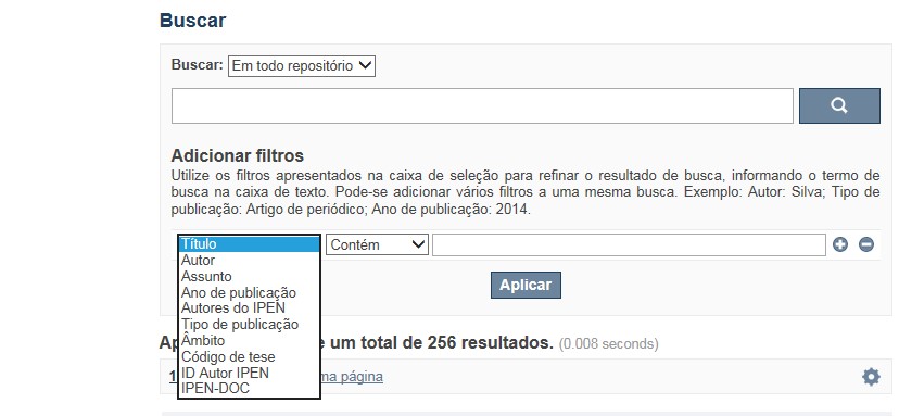
A opção Busca avançada utiliza os conectores da lógica boleana, é o melhor recurso para combinar chaves de busca e obter documentos relevantes à sua pesquisa, utilize os filtros apresentados na caixa de seleção para refinar o resultado de busca. Pode-se adicionar vários filtros a uma mesma busca.
Exemplo:
Buscar os artigos apresentados em um evento internacional de 2015, sobre loss of coolant, do autor Maprelian.
Autor: Maprelian
Título: loss of coolant
Tipo de publicação: Texto completo de evento
Ano de publicação: 2015
✔ Para indexação dos documentos é utilizado o Thesaurus do INIS, especializado na área nuclear e utilizado em todos os países membros da International Atomic Energy Agency – IAEA , por esse motivo, utilize os termos de busca de assunto em inglês; isto não exclui a busca livre por palavras, apenas o resultado pode não ser tão relevante ou pertinente.
✔ 95% do RD apresenta o texto completo do documento com livre acesso, para aqueles que apresentam o ![]() significa que e o documento está sujeito as leis de direitos autorais, solicita-se nesses casos contatar a Biblioteca do IPEN,
bibl@ipen.br
.
significa que e o documento está sujeito as leis de direitos autorais, solicita-se nesses casos contatar a Biblioteca do IPEN,
bibl@ipen.br
.
✔ Ao efetuar a busca por um autor o RD apresentará uma relação de todos os trabalhos depositados no RD. No lado direito da tela são apresentados os coautores com o número de trabalhos produzidos em conjunto bem como os assuntos abordados e os respectivos anos de publicação agrupados.
✔ O RD disponibiliza um quadro estatístico de produtividade, onde é possível visualizar o número dos trabalhos agrupados por tipo de coleção, a medida que estão sendo depositados no RD.
✔ Na página inicial nas referências são sinalizados todos os autores IPEN, ao clicar nesse símbolo ![]() será aberta uma nova página correspondente à aquele autor – trata-se da página do pesquisador.
será aberta uma nova página correspondente à aquele autor – trata-se da página do pesquisador.
✔ Na página do pesquisador, é possível verificar, as variações do nome, a relação de todos os trabalhos com texto completo bem como um quadro resumo numérico; há links para o Currículo Lattes e o Google Acadêmico ( quando esse for informado).
ATENÇÃO!
ESTE TEXTO "AJUDA" ESTÁ SUJEITO A ATUALIZAÇÕES CONSTANTES, A MEDIDA QUE NOVAS FUNCIONALIDADES E RECURSOS DE BUSCA FOREM SENDO DESENVOLVIDOS PELAS EQUIPES DA BIBLIOTECA E DA INFORMÁTICA.
O gerenciamento do Repositório está a cargo da Biblioteca do IPEN. Constam neste RI, até o presente momento 20.950 itens que tanto podem ser artigos de periódicos ou de eventos nacionais e internacionais, dissertações e teses, livros, capítulo de livros e relatórios técnicos. Para participar do RI-IPEN é necessário que pelo menos um dos autores tenha vínculo acadêmico ou funcional com o Instituto. Nesta primeira etapa de funcionamento do RI, a coleta das publicações é realizada periodicamente pela equipe da Biblioteca do IPEN, extraindo os dados das bases internacionais tais como a Web of Science, Scopus, INIS, SciElo além de verificar o Currículo Lattes. O RI-IPEN apresenta também um aspecto inovador no seu funcionamento. Por meio de metadados específicos ele está vinculado ao sistema de gerenciamento das atividades do Plano Diretor anual do IPEN (SIGEPI). Com o objetivo de fornecer dados numéricos para a elaboração dos indicadores da Produção Cientifica Institucional, disponibiliza uma tabela estatística registrando em tempo real a inserção de novos itens. Foi criado um metadado que contém um número único para cada integrante da comunidade científica do IPEN. Esse metadado se transformou em um filtro que ao ser acionado apresenta todos os trabalhos de um determinado autor independente das variáveis na forma de citação do seu nome.
A elaboração do projeto do RI do IPEN foi iniciado em novembro de 2013, colocado em operação interna em julho de 2014 e disponibilizado na Internet em junho de 2015. Utiliza o software livre Dspace, desenvolvido pelo Massachusetts Institute of Technology (MIT). Para descrição dos metadados adota o padrão Dublin Core. É compatível com o Protocolo de Arquivos Abertos (OAI) permitindo interoperabilidade com repositórios de âmbito nacional e internacional.
1. Portaria IPEN-CNEN/SP nº 387, que estabeleceu os princípios que nortearam a criação do RDI, clique aqui.
2. A experiência do Instituto de Pesquisas Energéticas e Nucleares (IPEN-CNEN/SP) na criação de um Repositório Digital Institucional – RDI, clique aqui.
O Repositório Digital do IPEN é um equipamento institucional de acesso aberto, criado com o objetivo de reunir, preservar, disponibilizar e conferir maior visibilidade à Produção Científica publicada pelo Instituto, desde sua criação em 1956.
Operando, inicialmente como uma base de dados referencial o Repositório foi disponibilizado na atual plataforma, em junho de 2015. No Repositório está disponível o acesso ao conteúdo digital de artigos de periódicos, eventos, nacionais e internacionais, livros, capítulos, dissertações, teses e relatórios técnicos.
A elaboração do projeto do RI do IPEN foi iniciado em novembro de 2013, colocado em operação interna em julho de 2014 e disponibilizado na Internet em junho de 2015. Utiliza o software livre Dspace, desenvolvido pelo Massachusetts Institute of Technology (MIT). Para descrição dos metadados adota o padrão Dublin Core. É compatível com o Protocolo de Arquivos Abertos (OAI) permitindo interoperabilidade com repositórios de âmbito nacional e internacional.
O gerenciamento do Repositório está a cargo da Biblioteca do IPEN. Constam neste RI, até o presente momento 20.950 itens que tanto podem ser artigos de periódicos ou de eventos nacionais e internacionais, dissertações e teses, livros, capítulo de livros e relatórios técnicos. Para participar do RI-IPEN é necessário que pelo menos um dos autores tenha vínculo acadêmico ou funcional com o Instituto. Nesta primeira etapa de funcionamento do RI, a coleta das publicações é realizada periodicamente pela equipe da Biblioteca do IPEN, extraindo os dados das bases internacionais tais como a Web of Science, Scopus, INIS, SciElo além de verificar o Currículo Lattes. O RI-IPEN apresenta também um aspecto inovador no seu funcionamento. Por meio de metadados específicos ele está vinculado ao sistema de gerenciamento das atividades do Plano Diretor anual do IPEN (SIGEPI). Com o objetivo de fornecer dados numéricos para a elaboração dos indicadores da Produção Cientifica Institucional, disponibiliza uma tabela estatística registrando em tempo real a inserção de novos itens. Foi criado um metadado que contém um número único para cada integrante da comunidade científica do IPEN. Esse metadado se transformou em um filtro que ao ser acionado apresenta todos os trabalhos de um determinado autor independente das variáveis na forma de citação do seu nome.