Navegação IPEN por Revista "Atmosphere"
- Página inicial
- →
- IPEN
- →
- Navegação IPEN por Revista
- Sobre
- Perfil Técnico
- Política de funcionamento
- Ajuda
- Apresentação
Navegação IPEN por Revista "Atmosphere"
Itens para a visualização no momento 1-10 de 10
-
OLIVEIRA, ALINE M. de; SOUZA, CRISTINA T.; OLIVEIRA, NARA P.M. de; MELO, ALINE K.S.; LOPES, FABIO J.S.
 ; LANDULFO, EDUARDO
; ELBERN, HENDRIK; HOELZEMANN, JUDITH J.. Analysis of atmospheric aerosol optical properties in the northeast Brazilian atmosphere with remote sensing data from MODIS and CALIOP/CALIPSO satellites, AERONET photometers and a ground-based Lidar.
Atmosphere,
v. 10,
n. 10,
p. 1-22,
2019.
DOI:
10.3390/atmos10100594
Abstract:
A 12-year analysis, from 2005 to 2016, of atmospheric aerosol optical properties focusing
for the first time on Northeast Brazil (NEB) was performed based on four di erent remote sensing
datasets: the Moderate Resolution Imaging Spectroradiometer (MODIS), the Aerosol Robotic Network
(AERONET), the Cloud-Aerosol LIDAR with Orthogonal Polarization (CALIOP) and a ground-based
Lidar from Natal. We evaluated and identified distinct aerosol types, considering Aerosol Optical
Depth (AOD) and Angström Exponent (AE). All analyses show that over the NEB, a low aerosol
scenario prevails, while there are two distinct seasons of more elevated AOD that occur every year,
from August to October and January to March. According to MODIS, AOD values ranges from 0.04 to
0.52 over the region with a mean of 0.20 and occasionally isolated outliers of up to 1.21. Aerosol types
were identified as sea spray, biomass burning, and dust aerosols mostly transported from tropical
Africa. Three case studies on days with elevated AOD were performed. All cases identified the
same aerosol types and modeled HYSPLIT backward trajectories confirmed their source-dependent
origins. This analysis is motivated by the implementation of an atmospheric chemistry model with an
advanced data assimilation system that will use the observational database over NEB with the model
to overcome high uncertainties in the model results induced by still unvalidated emission inventories.
; LANDULFO, EDUARDO
; ELBERN, HENDRIK; HOELZEMANN, JUDITH J.. Analysis of atmospheric aerosol optical properties in the northeast Brazilian atmosphere with remote sensing data from MODIS and CALIOP/CALIPSO satellites, AERONET photometers and a ground-based Lidar.
Atmosphere,
v. 10,
n. 10,
p. 1-22,
2019.
DOI:
10.3390/atmos10100594
Abstract:
A 12-year analysis, from 2005 to 2016, of atmospheric aerosol optical properties focusing
for the first time on Northeast Brazil (NEB) was performed based on four di erent remote sensing
datasets: the Moderate Resolution Imaging Spectroradiometer (MODIS), the Aerosol Robotic Network
(AERONET), the Cloud-Aerosol LIDAR with Orthogonal Polarization (CALIOP) and a ground-based
Lidar from Natal. We evaluated and identified distinct aerosol types, considering Aerosol Optical
Depth (AOD) and Angström Exponent (AE). All analyses show that over the NEB, a low aerosol
scenario prevails, while there are two distinct seasons of more elevated AOD that occur every year,
from August to October and January to March. According to MODIS, AOD values ranges from 0.04 to
0.52 over the region with a mean of 0.20 and occasionally isolated outliers of up to 1.21. Aerosol types
were identified as sea spray, biomass burning, and dust aerosols mostly transported from tropical
Africa. Three case studies on days with elevated AOD were performed. All cases identified the
same aerosol types and modeled HYSPLIT backward trajectories confirmed their source-dependent
origins. This analysis is motivated by the implementation of an atmospheric chemistry model with an
advanced data assimilation system that will use the observational database over NEB with the model
to overcome high uncertainties in the model results induced by still unvalidated emission inventories.
Palavras-Chave: aerosols; aerosol monitoring; optical radar; dusts; datasets; satellites; atmospherics; meteorology; optical properties; brazil; atmospheric circulation
. Analysis of atmospheric aerosol optical properties in the northeast Brazilian atmosphere with remote sensing data from MODIS and CALIOP/CALIPSO satellites, AERONET photometers and a ground-based Lidar. Atmosphere, v. 10, n. 10, p. 1-22, 2019. DOI: 10.3390/atmos10100594. Disponível em: http://repositorio.ipen.br/handle/123456789/30378. Acesso em: $DATA.Como referenciar este itemEsta referência é gerada automaticamente de acordo com as normas do estilo IPEN/SP (ABNT NBR 6023) e recomenda-se uma verificação final e ajustes caso necessário.

-
MOREIRA, GREGORI de A.
; CACHEFFO, ALEXANDRE
; ANDRADE, IZABEL da S.
; LOPES, FABIO JULIANO da S.
; GOMES, ANTONIO A.
; LANDULFO, EDUARDO
. Analyzing the influence of vehicular traffic on the concentration of pollutants in the city of São Paulo: an approach based on pandemic SARS-CoV-2 data and deep learning.
Atmosphere,
v. 14,
n. 10,
p. 1-16,
2023.
DOI:
10.3390/atmos14101578
Abstract:
This study employs surface and remote sensing data jointly with deep learning techniques
to examine the influence of vehicular traffic in the seasonal patterns of CO, NO2
, PM2.5, and PM10
concentrations in the São Paulo municipality, as the period of physical distancing (March 2020 to
December 2021), due to SARS-CoV-2 pandemic and the resumption of activities, made it possible to
observe significant variations in the flow of vehicles in the city of São Paulo. Firstly, an analysis of the
planetary boundary layer height and ventilation coefficient was performed to identify the seasons’
patterns of pollution dispersion. Then, the variations (from 2018 to 2021) of the seasonal average
values of air temperature, relative humidity, precipitation, and thermal inversion occurrence/position
were compared to identify possible variations in the patterns of such variables that would justify (or
deny) the occurrence of more favorable conditions for pollutants dispersion. However, no significant
variations were found. Finally, the seasonal average concentrations of the previously mentioned
pollutants were compared from 2018 to 2021, and the daily concentrations observed during the
pandemic period were compared with a model based on an artificial neural network. Regarding the
concentration of pollutants, the primarily sourced from vehicular traffic (CO and NO2
) exhibited
substantial variations, demonstrating an inverse relationship with the rate of social distancing.
In addition, the measured concentrations deviated from the predictive model during periods of
significant social isolation. Conversely, pollutants that were not primarily linked to vehicular sources
(PM2.5 and PM10) exhibited minimal variation from 2018 to 2021; thus, their measured concentration
remained consistent with the prediction model.
Palavras-Chave: urban areas; air pollution; air quality; machine learning; vehicles; coronaviruses
. Analyzing the influence of vehicular traffic on the concentration of pollutants in the city of São Paulo: an approach based on pandemic SARS-CoV-2 data and deep learning. Atmosphere, v. 14, n. 10, p. 1-16, 2023. DOI: 10.3390/atmos14101578. Disponível em: http://repositorio.ipen.br/handle/123456789/34210. Acesso em: $DATA.Como referenciar este itemEsta referência é gerada automaticamente de acordo com as normas do estilo IPEN/SP (ABNT NBR 6023) e recomenda-se uma verificação final e ajustes caso necessário.
-
MOREIRA, GREGORI de A.
; OLIVEIRA, AMAURI P. de; CODATO, GEORGIA; SANCHEZ, MACIEL P.; TITO, JANET V.; SILVA, LEONARDO A.H. e; SILVEIRA, LUCAS C. da; SILVA, JONATAN J. da
; LOPES, FABIO J. da S.
; LANDULFO, EDUARDO
. Assessing spatial variation of PBL height and aerosol layer aloft in São Paulo Megacity using simultaneously two lidar during winter 2019.
Atmosphere,
v. 13,
n. 4,
p. 1-16,
2022.
DOI:
10.3390/atmos13040611
Abstract:
This work presents the use of two elastic lidar systems to assess the horizontal variation of
the PBL height (PBLH) and aerosol layer aloft in the São Paulo Megacity. These two lidars performed
simultaneous measurements 10.7 km apart in a highly urbanized and relatively flat area of São Paulo
for two winter months of 2019. The results showed that the PBLH differences display diurnal
variation that depends on the PBL during daytime growth phases. Cloud and sea breeze effects
control most of PBLH variation. In the absence of cloud and sea breeze, the maximum difference
(~300 m) occurs in the rapid development stage and is due to topographic effects. When the PBL
approaches its maximum daily value, it tends to level off with respect to the topography. In addition,
it was presented a method that combines elastic lidar (to detect an aerosol layer) and satellite data
(to classify such a layer from Aerosol Optical Depth (AOD) and Aerosol Index (AI) information) for
the detection of biomass burning events. This methodology demonstrated that the variations caused
by Biomass Burning in AOD and AI enable both the detection of aerosol plumes originating from
biomass burning and the identification of their origin.
Palavras-Chave: boundary layers; earth atmosphere; biomass; burns; urban areas; optical radar
. Assessing spatial variation of PBL height and aerosol layer aloft in São Paulo Megacity using simultaneously two lidar during winter 2019. Atmosphere, v. 13, n. 4, p. 1-16, 2022. DOI: 10.3390/atmos13040611. Disponível em: http://repositorio.ipen.br/handle/123456789/33156. Acesso em: $DATA.Como referenciar este itemEsta referência é gerada automaticamente de acordo com as normas do estilo IPEN/SP (ABNT NBR 6023) e recomenda-se uma verificação final e ajustes caso necessário.
-
VIEIRA, ERICK V.R.; ROSARIO, NILTON E. do; YAMASOE, MARCIA A.; MORAIS, FERNANDO G.; MARTINEZ, PEDRO J.P.; LANDULFO, EDUARDO
; MIRANDA, REGINA M. de. Chemical characterization and optical properties of the aerosol in São Paulo, Brazil.
Atmosphere,
v. 14,
n. 9,
p. 1-21,
2023.
DOI:
10.3390/atmos14091460
Abstract:
: Air pollution in the Metropolitan Area of São Paulo (MASP), Brazil, is a serious problem
and is strongly affected by local sources. However, atmosphere column composition in MASP is
also affected by biomass burning aerosol (BB). Understanding the impacts of aerosol particles, from
both vehicles and BB, on the air quality and climate depends on in-depth research with knowledge
of some parameters such as the optical properties of particles and their chemical composition. This
study characterized fine particulate matter (PM2.5) from July 2019 to August 2020 in the eastern part
of the MASP, relating the chemical composition data obtained at the surface and columnar optical
parameters, such as aerosol optical depth (AOD), Ångström Exponent (AE), and single-scattering
albedo (SSA). According to the analyzed data, the mean PM2.5 concentration was 18.0 ± 12.5 µg/m3
;
however, daily events exceeded 75 times the air quality standard of the World Health Organization
(15 µg/m3
). The mean black carbon concentration was 1.8 ± 1.5 µg/m3
in the sampling period.
Positive matrix factorization (PMF) identified four main sources of aerosol: heavy vehicles (42%),
followed by soil dust plus local sources (38.7%), light vehicles (9.9%), and local sources (8.6%).
AOD and AE presented the highest values in the dry period, during which biomass burning events
are more frequent, suggesting smaller particles in the atmosphere. SSA values at 440 nm were
between 0.86 and 0.94, with lower values in the winter months, indicating the presence of more
absorbing aerosol.
Palavras-Chave: particulates; air pollution; air quality; urban areas; aerosols; optical properties
. Chemical characterization and optical properties of the aerosol in São Paulo, Brazil. Atmosphere, v. 14, n. 9, p. 1-21, 2023. DOI: 10.3390/atmos14091460. Disponível em: http://repositorio.ipen.br/handle/123456789/34211. Acesso em: $DATA.Como referenciar este itemEsta referência é gerada automaticamente de acordo com as normas do estilo IPEN/SP (ABNT NBR 6023) e recomenda-se uma verificação final e ajustes caso necessário.
-
CASSOL, HENRIQUE L.G.; DOMINGUES, LUCAS G.; SANCHEZ, ALBER H.; BASSO, LUANA S.; MARANI, LUCIANO; TEJADA, GRACIELA; ARAI, EGIDIO; CORREIA, CAIO
; ALDEN, CAROLINE B.; MILLER, JOHN B.; GLOOR, MANUEL; ANDERSON, LIANA O.; ARAGÃO, LUIZ E.O.C.; GATTI, LUCIANA V.
. Determination of region of influence obtained by aircraft vertical profiles using the density of trajectories from the HYSPLIT model.
Atmosphere,
v. 11,
n. 10,
p. 1-20,
2020.
DOI:
10.3390/atmos11101073
Abstract:
Aircraft atmospheric profiling is a valuable technique for determining greenhouse gas
fluxes at regional scales (104–106 km2). Here, we describe a new, simple method for estimating the
surface influence of air samples that uses backward trajectories based on the Lagrangian model
Hybrid Single-Particle Lagrangian Integrated Trajectory Model (HYSPLIT). We determined “regions
of influence” on a quarterly basis between 2010 and 2018 for four aircraft vertical profile sites: SAN
and ALF in the eastern Amazon, and RBA and TAB or TEF in the western Amazon. We evaluated
regions of influence in terms of their relative sensitivity to areas inside and outside the Amazon and
their total area inside the Amazon. Regions of influence varied by quarter and less so by year. In the
first and fourth quarters, the contribution of the region of influence inside the Amazon was 83–93%
for all sites, while in the second and third quarters, it was 57–75%. The interquarter differences are
more evident in the eastern than in the western Amazon. Our analysis indicates that atmospheric
profiles from the western sites are sensitive to 42–52.2% of the Amazon. In contrast, eastern Amazon
sites are sensitive to only 10.9–25.3%. These results may help to spatially resolve the response of
greenhouse gas emissions to climate variability over Amazon.
Palavras-Chave: aircraft; atmospheres; greenhouses; air quality; sampling; greenhouse gases; air pollution; air flow; carbon dioxide; carbon footprint
. Determination of region of influence obtained by aircraft vertical profiles using the density of trajectories from the HYSPLIT model. Atmosphere, v. 11, n. 10, p. 1-20, 2020. DOI: 10.3390/atmos11101073. Disponível em: http://200.136.52.105/handle/123456789/31593. Acesso em: $DATA.Como referenciar este itemEsta referência é gerada automaticamente de acordo com as normas do estilo IPEN/SP (ABNT NBR 6023) e recomenda-se uma verificação final e ajustes caso necessário.
-
IBARRA-ESPINOSA, SERGIO
; FREITAS, EDMILSON D. de; ANDRADE, MARIA de F.; LANDULFO, EDUARDO
. Effects of evaporative emissions control measurements on ozone concentrations in Brazil.
Atmosphere,
v. 13,
n. 1,
p. 1-14,
2022.
DOI:
10.3390/atmos13010082
Abstract:
In this work, the possible benefits obtained due to the implementation of evaporative
emissions control measures, originating from vehicle fueling processes, on ozone concentrations
are verified. The measures studied are: (1) control at the moment when the tank trucks supply the
fuel to the gas stations (Stage 1); (2) control at the moment when the vehicles are refueled at the gas
stations, through a device installed in the pumps (Stage 2); (3) same as the previous control, but
through a device installed in the vehicles (ORVR). The effects of these procedures were analyzed using
numerical modeling with the VEIN and WRF/Chem models for a base case in 2018 and different
emission scenarios, both in 2018 and 2031. The results obtained for 2018 show that the implementation
of Stages 1 and 2 would reduce HCNM emissions by 47.96%, with a consequent reduction of 19.9%
in the average concentrations of tropospheric ozone. For 2031, the greatest reductions in ozone
concentrations were obtained with the scenario without ORVR, and with Stage 1 and Stage 2 (64.65%
reduction in HCNM emissions and 31.93% in ozone), followed by the scenario with ORVR and with
Stage 1 and Stage 2 (64.39% reduction in HCNM emissions and 32.98% in ozone concentrations).
Palavras-Chave: ozone; air quality; vehicles; pollutants; emission; air pollution control; carbon monoxide
. Effects of evaporative emissions control measurements on ozone concentrations in Brazil. Atmosphere, v. 13, n. 1, p. 1-14, 2022. DOI: 10.3390/atmos13010082. Disponível em: http://repositorio.ipen.br/handle/123456789/32953. Acesso em: $DATA.Como referenciar este itemEsta referência é gerada automaticamente de acordo com as normas do estilo IPEN/SP (ABNT NBR 6023) e recomenda-se uma verificação final e ajustes caso necessário.
-
PALACIOS, RAFAEL; NASSARDEN, DANIELLE C.S.; FRANCO, MARCO A.; MORAIS, FERNANDO G.
; MACHADO, LUIZ A.T.; RIZZO, LUCIANA V.; CIRINO, GLAUBER; PEREIRA, AUGUSTO G.C.; RIBEIRO, PRISCILA dos S.; BARROS, LUCAS R.C.; BIUDES, MARCELO S.; CURADO, LEONE F.A.; RODRIGUES, THIAGO R.; MENEZES, JORGE; LANDULFO, EDUARDO
; ARTAXO, PAULO. Evaluation of MODIS Dark Target AOD product with 3 and 10 km resolution in Amazonia.
Atmosphere,
v. 13,
n. 11,
p. 1-16,
2022.
DOI:
10.3390/atmos13111742
Abstract:
The techniques and analyses employed by remote sensing provide key information about atmospheric particle properties at regional and global scales. However, limitations in optical spectral models used to represent the different types of aerosols in the atmosphere and their effects (direct and indirect) are still one of the major causes of sources of uncertainties and substantial impacts in climate prediction. There are no studies yet in South America, especially in the Amazon Basin, that have evaluated the advantages, disadvantages, inconsistencies, applicability, and suitability of the MODIS sensor (Moderate Resolution Imaging Spectroradiometer) destined for monitoring the ambient aerosol optical thickness over rivers and continents. In this study, the results of the DT (Dark Target) algorithm for products with 3 km and 10 km resolutions were systematically evaluated for six sites in the Amazon rainforest. The comparisons between the products were carried out with the AERONET (Aerosol Robotic Network) measurements, which were used as reference. Statistical parameters between AERONET vs. MODIS were also evaluated based on biomass burning records in the site regions. Here, the DT 10 km product showed satisfactory performance for the Amazon region, with observations between the expected error (EE) limits above 66%, in addition to R > 0.8 and RMSE < 0.3. However, the regional analysis for the two sites in the central and southern regions of the Amazon basin did not have the same performance, where the results showed an EE of 24 and 47%, respectively. The DT 3 km product did not perform well in any site, with an EE below 50%. Both products overestimated the AOD, but the 3 km product overestimated it approximately four times more due to its algorithm setup. Thus, we recommend the 10 km product for general analysis in Amazonia. Regional biomass burning records showed a direct relationship with the AERONET vs. MODIS DT with overestimation of both products. All variations between products and sites were justified based on the difficulty of retrieving surface reflectance and the model selected for local aerosols. Improvements in the optical spectral model currently implemented in the algorithms, with more realistic representations of the main types of the aerosol present in the Amazon Basin, may contribute to better performance among the evaluated products.
Palavras-Chave: aerosol monitoring; remote sensing; satellites; sensors; amazon river
. Evaluation of MODIS Dark Target AOD product with 3 and 10 km resolution in Amazonia. Atmosphere, v. 13, n. 11, p. 1-16, 2022. DOI: 10.3390/atmos13111742. Disponível em: http://repositorio.ipen.br/handle/123456789/33367. Acesso em: $DATA.Como referenciar este itemEsta referência é gerada automaticamente de acordo com as normas do estilo IPEN/SP (ABNT NBR 6023) e recomenda-se uma verificação final e ajustes caso necessário.
-
LARROZA, ELIANE G.
; KECKHUT, PHILIPPE; BARAY, JEAN-LUC; NAKAEMA, WALTER M.; VEREMES, HELENE; LANDULFO, EDUARDO
; DIONISI, DAVIDE; KHAYKIN, SERGEY; RAVETTA, FRANCOIS. Long-range transport of water channelized through the southern subtropical jet.
Atmosphere,
v. 9,
n. 10,
2018.
DOI:
10.3390/atmos9100374
Abstract:
In this study, an air mass (containing a cirrus cloud) was detected by light detection and ranging (lidar) above São Paulo (Brazil) in June 2007 and tracked around the globe, thanks to Lagrangian calculations as well as ground-based and satellite observations. Cloud-Aerosol Lidar and Infrared Pathfinder Satellite Observation (CALIPSO) data were also used to provide locations of occurrence of cirrus around the globe and extract their respective macro physical parameters (altitude and temperature). An analysis of the air mass history based on Lagrangian trajectories reveals that water coming from the Equator is channelized through the southern subtropical jet for weeks. In this case, the back-trajectories showed that the cirrus cloud detected at São Paulo was a mixture of air masses from two different locations: (1) the active convective area located around the Equator, with transport into the upper troposphere that promotes cirrus cloud formation; and (2) the South Pacific Ocean, with transport that follows the subtropical jet stream (STJ). Air masses coming from equatorial convective regions are trapped by the jet, which contributes to maintaining the lifetime of the cirrus cloud for a few days. The cloud disappears near the African continent, due to a southern excursion and warmer temperatures, then reappears and is detected again by the lidar system in São Paulo after 12 days. The observed cloud is located at a similar altitude, revealing that sedimentation is small or compensated by radiative uplift.
Palavras-Chave: clouds; aerosols; atmospheres; optical radar; lagrangian function; satellite atmospheres; stratosphere; rayleigh scattering; brazil; water vapor
. Long-range transport of water channelized through the southern subtropical jet. Atmosphere, v. 9, n. 10, 2018. DOI: 10.3390/atmos9100374. Disponível em: http://repositorio.ipen.br/handle/123456789/29317. Acesso em: $DATA.Como referenciar este itemEsta referência é gerada automaticamente de acordo com as normas do estilo IPEN/SP (ABNT NBR 6023) e recomenda-se uma verificação final e ajustes caso necessário.
-
DOMINGUES, LUCAS G.
; GATTI, LUCIANA V.
; AQUINO, AFONSO
; SÁNCHEZ, ALBER; CORREIA, CAIO
; GLOOR, MANUEL; PETERS, WOUTER; MILLER, JOHN; TURNBULL, JOCELYN; SANTANA, RICARDO
; MARANI, LUCIANO; CÂMARA, GILBERTO; NEVES, RAIANE; CRISPIM, STÉPHANE. A new background method for greenhouse gases flux calculation based in back-trajectories over the Amazon.
Atmosphere,
v. 11,
n. 7,
p. 1-8,
2020.
DOI:
10.3390/atmos11070734
Abstract:
The large amount of carbon stored in trees and soils of the Amazon rain forest is under
pressure from land use as well as climate change. Therefore, various efforts to monitor greenhouse
gas exchange between the Amazon forest and the atmosphere are now ongoing, including regular
vertical profile (surface to 4.5 km) greenhouse gas measurements across the Amazon. These profile
measurements can be used to calculate fluxes to and from the rain forest to the atmosphere at
large spatial scales by considering the enhancement or depletion relative to the mole fraction of
air entering the Amazon basin from the Atlantic, providing an important diagnostic of the state,
changes and sensitivities of the forests. Previous studies have estimated greenhouse gas mole fractions
of incoming air (‘background’) as a weighted mean of mole fractions measured at two background
sites, Barbados (Northern Hemisphere) and Ascension (Southern hemisphere) in the Tropical Atlantic,
where the weights were based on sulphur hexafluoride (SF6) measured locally (in the Amazon vertical
profiles) and at the two background sites. However, this method requires the accuracy and precision
of SF6 measurements to be significantly better than 0.1 parts per trillion (picomole mole1), which is
near the limit for the best SF6 measurements and assumes that there are no SF6 sources in the Amazon
basin. We therefore present here an alternative method. Instead of using SF6, we use the geographical
position of each air-mass back-trajectory when it intersects the limit connecting these two sites to
estimate contributions from Barbados versus Ascension. We furthermore extend the approach to
include an observation site further south, Cape Point, South Africa. We evaluate our method using
CO2 vertical profile measurements at a coastal site in Brazil comparing with values obtained using
this method where we find a high correlation (r2 = 0.77). Similarly, we obtain good agreement for CO2
background when comparing our results with those based on SF6, for the period 2010–2011 when
the SF6 measurements had excellent precision and accuracy. We also found high correspondence
between the methods for background values of CO, N2O and CH4. Finally, flux estimates based
on our new method agree well with the CO2 flux estimates for 2010 and 2011 estimated using the SF6-based method. Together, our findings suggest that our trajectory-based method is a robust new
way to derive background air concentrations for the purpose of greenhouse gas flux estimation using
vertical profile data.
Palavras-Chave: carbon dioxide; greenhouses; greenhouse gases; climatic change; environmental impacts; biomass; soils; forests; sedimentary basins; amazon river
. A new background method for greenhouse gases flux calculation based in back-trajectories over the Amazon. Atmosphere, v. 11, n. 7, p. 1-8, 2020. DOI: 10.3390/atmos11070734. Disponível em: http://repositorio.ipen.br/handle/123456789/31464. Acesso em: $DATA.Como referenciar este itemEsta referência é gerada automaticamente de acordo com as normas do estilo IPEN/SP (ABNT NBR 6023) e recomenda-se uma verificação final e ajustes caso necessário.
-
MORAIS, FERNANDO G.
; FRANCO, MARCO A.; PALACIOS, RAFAEL; MACHADO, LUIZ A.T.; RIZZO, LUCIANA V.; BARBOSA, HENRIQUE M.J.; JORGE, FABIO; SCHAFER, JOEL S.; HOLBEN, BRENT N.; LANDULFO, EDUARDO
; ARTAXO, PAULO. Relationship between land use and spatial variability of atmospheric brown carbon and black carbon aerosols in Amazonia.
Atmosphere,
v. 13,
n. 8,
p. 1-17,
2022.
DOI:
10.3390/atmos13081328
Abstract:
The aerosol radiative effect is an important source of uncertainty in estimating the anthropogenic impact of global climate change. One of the main open questions is the role of radiation absorption by aerosols and its relation to land use worldwide, particularly in the Amazon Rainforest. Using AERONET (Aerosol Robotic Network) long-term measurements of aerosol optical depth (AOD) at a wavelength of 500 nm and absorption AOD (AAOD) at wavelengths of 440, 675, and 870 nm, we estimated the fraction and seasonality of the black carbon (BC) and brown carbon (BrC) contributions to absorption at 440 nm. This was conducted at six Amazonian sites, from central Amazon (Manaus and the Amazon Tall Tower Observatory—ATTO) to the deforestation arc (Rio Branco, Cuiabá, Ji-Paraná, and Alta Floresta). In addition, land use and cover data from the MapBiomas collection 6.0 was used to access the land transformation from forest to agricultural areas on each site. The results showed, for the first time, important geographical and seasonal variability in the aerosol optical properties, particularly the BC and BrC contributions. We observed a clear separation between dry and wet seasons, with BrC consistently accounting for an average of approximately 12% of the aerosol AAOD at 440 nm in the deforestation arc. In central Amazon, the contribution of BrC was approximately 25%. A direct relationship between the reduction in forests and the increase in the area dedicated to agriculture was detected. Moreover, places with lower fractions of forest had a smaller fraction of BrC, and regions with higher fractions of agricultural areas presented higher fractions of BC. Therefore, significant changes in AOD and AAOD are likely related to land-use transformations and biomass burning emissions, mainly during the dry season. The effects of land use change could introduce differences in the radiative balance in the different Amazonian regions. The analyses presented in this study allow a better understanding of the role of aerosol emissions from the Amazon Rainforest that could have global impacts.
Palavras-Chave: aerosol monitoring; remote sensing; carbon; land use; amazon river
. Relationship between land use and spatial variability of atmospheric brown carbon and black carbon aerosols in Amazonia. Atmosphere, v. 13, n. 8, p. 1-17, 2022. DOI: 10.3390/atmos13081328. Disponível em: http://repositorio.ipen.br/handle/123456789/33368. Acesso em: $DATA.Como referenciar este itemEsta referência é gerada automaticamente de acordo com as normas do estilo IPEN/SP (ABNT NBR 6023) e recomenda-se uma verificação final e ajustes caso necessário.
Itens para a visualização no momento 1-10 de 10
Buscar no repositório
Navegar
Minha conta
Visualizar
A pesquisa no RD utiliza os recursos de busca da maioria das bases de dados. No entanto algumas dicas podem auxiliar para obter um resultado mais pertinente.
✔ É possível efetuar a busca de um autor ou um termo em todo o RD, por meio do Buscar no Repositório , isto é, o termo solicitado será localizado em qualquer campo do RD. No entanto esse tipo de pesquisa não é recomendada a não ser que se deseje um resultado amplo e generalizado.
✔ A pesquisa apresentará melhor resultado selecionando um dos filtros disponíveis em Navegar
✔ Os filtros disponíveis em Navegar tais como: Coleções, Ano de publicação, Títulos, Assuntos, Autores, Revista, Tipo de publicação são autoexplicativos. O filtro, Autores IPEN apresenta uma relação com os autores vinculados ao IPEN; o ID Autor IPEN diz respeito ao número único de identificação de cada autor constante no RD e sob o qual estão agrupados todos os seus trabalhos independente das variáveis do seu nome; Tipo de acesso diz respeito à acessibilidade do documento, isto é , sujeito as leis de direitos autorais, ID RT apresenta a relação dos relatórios técnicos, restritos para consulta das comunidades indicadas.
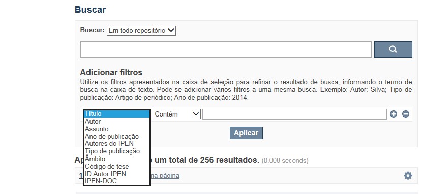
A opção Busca avançada utiliza os conectores da lógica boleana, é o melhor recurso para combinar chaves de busca e obter documentos relevantes à sua pesquisa, utilize os filtros apresentados na caixa de seleção para refinar o resultado de busca. Pode-se adicionar vários filtros a uma mesma busca.
Exemplo:
Buscar os artigos apresentados em um evento internacional de 2015, sobre loss of coolant, do autor Maprelian.
Autor: Maprelian
Título: loss of coolant
Tipo de publicação: Texto completo de evento
Ano de publicação: 2015
✔ Para indexação dos documentos é utilizado o Thesaurus do INIS, especializado na área nuclear e utilizado em todos os países membros da International Atomic Energy Agency – IAEA , por esse motivo, utilize os termos de busca de assunto em inglês; isto não exclui a busca livre por palavras, apenas o resultado pode não ser tão relevante ou pertinente.
✔ 95% do RD apresenta o texto completo do documento com livre acesso, para aqueles que apresentam o ![]() significa que e o documento está sujeito as leis de direitos autorais, solicita-se nesses casos contatar a Biblioteca do IPEN,
bibl@ipen.br
.
significa que e o documento está sujeito as leis de direitos autorais, solicita-se nesses casos contatar a Biblioteca do IPEN,
bibl@ipen.br
.
✔ Ao efetuar a busca por um autor o RD apresentará uma relação de todos os trabalhos depositados no RD. No lado direito da tela são apresentados os coautores com o número de trabalhos produzidos em conjunto bem como os assuntos abordados e os respectivos anos de publicação agrupados.
✔ O RD disponibiliza um quadro estatístico de produtividade, onde é possível visualizar o número dos trabalhos agrupados por tipo de coleção, a medida que estão sendo depositados no RD.
✔ Na página inicial nas referências são sinalizados todos os autores IPEN, ao clicar nesse símbolo ![]() será aberta uma nova página correspondente à aquele autor – trata-se da página do pesquisador.
será aberta uma nova página correspondente à aquele autor – trata-se da página do pesquisador.
✔ Na página do pesquisador, é possível verificar, as variações do nome, a relação de todos os trabalhos com texto completo bem como um quadro resumo numérico; há links para o Currículo Lattes e o Google Acadêmico ( quando esse for informado).
ATENÇÃO!
ESTE TEXTO "AJUDA" ESTÁ SUJEITO A ATUALIZAÇÕES CONSTANTES, A MEDIDA QUE NOVAS FUNCIONALIDADES E RECURSOS DE BUSCA FOREM SENDO DESENVOLVIDOS PELAS EQUIPES DA BIBLIOTECA E DA INFORMÁTICA.
O gerenciamento do Repositório está a cargo da Biblioteca do IPEN. Constam neste RI, até o presente momento 20.950 itens que tanto podem ser artigos de periódicos ou de eventos nacionais e internacionais, dissertações e teses, livros, capítulo de livros e relatórios técnicos. Para participar do RI-IPEN é necessário que pelo menos um dos autores tenha vínculo acadêmico ou funcional com o Instituto. Nesta primeira etapa de funcionamento do RI, a coleta das publicações é realizada periodicamente pela equipe da Biblioteca do IPEN, extraindo os dados das bases internacionais tais como a Web of Science, Scopus, INIS, SciElo além de verificar o Currículo Lattes. O RI-IPEN apresenta também um aspecto inovador no seu funcionamento. Por meio de metadados específicos ele está vinculado ao sistema de gerenciamento das atividades do Plano Diretor anual do IPEN (SIGEPI). Com o objetivo de fornecer dados numéricos para a elaboração dos indicadores da Produção Cientifica Institucional, disponibiliza uma tabela estatística registrando em tempo real a inserção de novos itens. Foi criado um metadado que contém um número único para cada integrante da comunidade científica do IPEN. Esse metadado se transformou em um filtro que ao ser acionado apresenta todos os trabalhos de um determinado autor independente das variáveis na forma de citação do seu nome.
A elaboração do projeto do RI do IPEN foi iniciado em novembro de 2013, colocado em operação interna em julho de 2014 e disponibilizado na Internet em junho de 2015. Utiliza o software livre Dspace, desenvolvido pelo Massachusetts Institute of Technology (MIT). Para descrição dos metadados adota o padrão Dublin Core. É compatível com o Protocolo de Arquivos Abertos (OAI) permitindo interoperabilidade com repositórios de âmbito nacional e internacional.
1. Portaria IPEN-CNEN/SP nº 387, que estabeleceu os princípios que nortearam a criação do RDI, clique aqui.
2. A experiência do Instituto de Pesquisas Energéticas e Nucleares (IPEN-CNEN/SP) na criação de um Repositório Digital Institucional – RDI, clique aqui.
O Repositório Digital do IPEN é um equipamento institucional de acesso aberto, criado com o objetivo de reunir, preservar, disponibilizar e conferir maior visibilidade à Produção Científica publicada pelo Instituto, desde sua criação em 1956.
Operando, inicialmente como uma base de dados referencial o Repositório foi disponibilizado na atual plataforma, em junho de 2015. No Repositório está disponível o acesso ao conteúdo digital de artigos de periódicos, eventos, nacionais e internacionais, livros, capítulos, dissertações, teses e relatórios técnicos.
A elaboração do projeto do RI do IPEN foi iniciado em novembro de 2013, colocado em operação interna em julho de 2014 e disponibilizado na Internet em junho de 2015. Utiliza o software livre Dspace, desenvolvido pelo Massachusetts Institute of Technology (MIT). Para descrição dos metadados adota o padrão Dublin Core. É compatível com o Protocolo de Arquivos Abertos (OAI) permitindo interoperabilidade com repositórios de âmbito nacional e internacional.
O gerenciamento do Repositório está a cargo da Biblioteca do IPEN. Constam neste RI, até o presente momento 20.950 itens que tanto podem ser artigos de periódicos ou de eventos nacionais e internacionais, dissertações e teses, livros, capítulo de livros e relatórios técnicos. Para participar do RI-IPEN é necessário que pelo menos um dos autores tenha vínculo acadêmico ou funcional com o Instituto. Nesta primeira etapa de funcionamento do RI, a coleta das publicações é realizada periodicamente pela equipe da Biblioteca do IPEN, extraindo os dados das bases internacionais tais como a Web of Science, Scopus, INIS, SciElo além de verificar o Currículo Lattes. O RI-IPEN apresenta também um aspecto inovador no seu funcionamento. Por meio de metadados específicos ele está vinculado ao sistema de gerenciamento das atividades do Plano Diretor anual do IPEN (SIGEPI). Com o objetivo de fornecer dados numéricos para a elaboração dos indicadores da Produção Cientifica Institucional, disponibiliza uma tabela estatística registrando em tempo real a inserção de novos itens. Foi criado um metadado que contém um número único para cada integrante da comunidade científica do IPEN. Esse metadado se transformou em um filtro que ao ser acionado apresenta todos os trabalhos de um determinado autor independente das variáveis na forma de citação do seu nome.