Navegação Eventos - Resumos por Autores IPEN "LANDULFO, EDUARDO"
- Página inicial
- →
- IPEN
- →
- Eventos - Resumos
- →
- Navegação Eventos - Resumos por Autores IPEN
- Sobre
- Perfil Técnico
- Política de funcionamento
- Ajuda
- Apresentação
Navegação Eventos - Resumos por Autores IPEN "LANDULFO, EDUARDO"
Itens para a visualização no momento 1-20 de 53
-
LOPES, FABIO J.S.
 ; GUERRERO-RASCADO, JUAN L.; LANDULFO, EDUARDO
; KROTKOV, NICKOLAY; HUGHES, ERIC; SILVA, ARLINDO da. Aerosol layer observation of 2015 Calbuco volcanic eruption over the LALINET São Paulo station.
In: WORKSHOP ON LIDAR MEASUREMENTS IN LATIN AMERICA, 9th,
July 17-22, 2016,
Santos, SP.
Abstract...
2016.
Abstract:
On the 22nd of April 2015, the Calbuco volcano sited at the South region of Chile had its first eruption since 1972, injecting a huge plume of volcanic aerosol particles and gases up to 21 km into the atmosphere. As part of the Latin America Lidar Network’s (LALINET) aim to monitor any atmospheric event the LALINET São Paulo station (SPU) started continuous observation in order to monitor the dispersion of volcanic aerosol layer and their altitude and optical properties. After 5 days, on 27 April 2015, some volcanic plumes arrived over the Metropolitan area of São Paulo (MASP) and were detected by the SPU system within the altitude range of 18-19 km. The timing and altitude of SPU observations coincide with transport and dispersion simulations of the volcanic cloud’s arrival at São Paulo, from the Goddard Earth Observing System Model, version 5 (GEOS-5) and Goddard Chemistry Aerosol Radiation and Transport (GOCART) model from NASA Goddard Space Flight Center. The models simulate the volcanic eruption’s injection of SO2, SO4, and ash into the atmosphere and the advection of the volcanic plume away from the volcano. The purpose of this study is to determine the optical properties of the volcanic plume such as AOD and Lidar ratio. Applying the transmittance method used previously for cirrus clouds it was possible to retrieve the AOD value of 0.16 ± 0.21 and a lidar ratio of 64 ± 4 sr.
. Aerosol layer observation of 2015 Calbuco volcanic eruption over the LALINET São Paulo station. In: WORKSHOP ON LIDAR MEASUREMENTS IN LATIN AMERICA, 9th, July 17-22, 2016, Santos, SP. Abstract... 2016. Disponível em: http://repositorio.ipen.br/handle/123456789/27992. Acesso em: $DATA.Como referenciar este item
; GUERRERO-RASCADO, JUAN L.; LANDULFO, EDUARDO
; KROTKOV, NICKOLAY; HUGHES, ERIC; SILVA, ARLINDO da. Aerosol layer observation of 2015 Calbuco volcanic eruption over the LALINET São Paulo station.
In: WORKSHOP ON LIDAR MEASUREMENTS IN LATIN AMERICA, 9th,
July 17-22, 2016,
Santos, SP.
Abstract...
2016.
Abstract:
On the 22nd of April 2015, the Calbuco volcano sited at the South region of Chile had its first eruption since 1972, injecting a huge plume of volcanic aerosol particles and gases up to 21 km into the atmosphere. As part of the Latin America Lidar Network’s (LALINET) aim to monitor any atmospheric event the LALINET São Paulo station (SPU) started continuous observation in order to monitor the dispersion of volcanic aerosol layer and their altitude and optical properties. After 5 days, on 27 April 2015, some volcanic plumes arrived over the Metropolitan area of São Paulo (MASP) and were detected by the SPU system within the altitude range of 18-19 km. The timing and altitude of SPU observations coincide with transport and dispersion simulations of the volcanic cloud’s arrival at São Paulo, from the Goddard Earth Observing System Model, version 5 (GEOS-5) and Goddard Chemistry Aerosol Radiation and Transport (GOCART) model from NASA Goddard Space Flight Center. The models simulate the volcanic eruption’s injection of SO2, SO4, and ash into the atmosphere and the advection of the volcanic plume away from the volcano. The purpose of this study is to determine the optical properties of the volcanic plume such as AOD and Lidar ratio. Applying the transmittance method used previously for cirrus clouds it was possible to retrieve the AOD value of 0.16 ± 0.21 and a lidar ratio of 64 ± 4 sr.
. Aerosol layer observation of 2015 Calbuco volcanic eruption over the LALINET São Paulo station. In: WORKSHOP ON LIDAR MEASUREMENTS IN LATIN AMERICA, 9th, July 17-22, 2016, Santos, SP. Abstract... 2016. Disponível em: http://repositorio.ipen.br/handle/123456789/27992. Acesso em: $DATA.Como referenciar este itemEsta referência é gerada automaticamente de acordo com as normas do estilo IPEN/SP (ABNT NBR 6023) e recomenda-se uma verificação final e ajustes caso necessário.

-
LANDULFO, EDUARDO
; LOPES, FABIO J. da S.; NAKAEMA, WALTER M.; LARROZA, ELIANE G.; ARAUJO, FELIPE V.; RODRIGUES, PATRICIA F.; RISTORI, PABLO; OTERO, LIDIA; PALLOTTA, JUAN; PAWELKO, EZEQUIEL; CHOUZA, FERNANDO; QUEL, EDUARDO; FORNO, R.; SANCHEZ, MARIA F.; CALDERON, FERNANDO; BARBOSA, HENRIQUE; GOUVEIA, DIEGO A.; ARTAXO, PAULO; MONTILLA, E.; SILVA, ANTONIETA; JIMENEZ, C.; SAAVEDRA, CALOS; HERNANDEZ, ROLANDO; ARREDONDO, RENE E.; GONZALEZ, BORIS B.; BRUNETA, CARLOS E.H.; SANCHEZ, JUAN C.A.; MARRERO, JUAN C.A.; GUSTIN, ALVARO B.; TOLEDO, DANIEL N.; BEDOYA, ANDRES; ALEGRIA, DAIRO; MUNERA, MAURICIO; WHITEMAN, DAVID. ALINE network status.
In: WORKSHOP ON LIDAR MEASUREMENTS IN LATIN AMERICA, 7th,
November 11-16, 2013,
Pucón, Chile.
Abstract...
2013.
p. 56.
Palavras-Chave: optical radar; computer networks; aerosol monitoring; climatic change; biomass; fires; seasonal variations; volcanic regions; latin america
. ALINE network status. In: WORKSHOP ON LIDAR MEASUREMENTS IN LATIN AMERICA, 7th, November 11-16, 2013, Pucón, Chile. Abstract... 2013. p. 56. Disponível em: http://repositorio.ipen.br/handle/123456789/20253. Acesso em: $DATA.Como referenciar este itemEsta referência é gerada automaticamente de acordo com as normas do estilo IPEN/SP (ABNT NBR 6023) e recomenda-se uma verificação final e ajustes caso necessário.
-
AMARAL, MARCELLO M.
; RAELE, MARCUS P.
; LANDULFO, EDUARDO
; VIEIRA JUNIOR, NILSON D.
; FREITAS, ANDERSON Z. de
. Application of LIDAR-like equations to OCT signal analysis for total extinction coefficient determination.
In: ENCONTRO NACIONAL DE FISICA DA MATERIA CONDENSADA, 33.,
10-14 de maio, 2010,
Aguas de Lindoia, SP.
Resumos...
2010.
Palavras-Chave: tomography; optical properties; interferometry; biological materials; animal tissues; diagnosis
. Application of LIDAR-like equations to OCT signal analysis for total extinction coefficient determination. In: ENCONTRO NACIONAL DE FISICA DA MATERIA CONDENSADA, 33., 10-14 de maio, 2010, Aguas de Lindoia, SP. Resumos... 2010. Disponível em: http://repositorio.ipen.br/handle/123456789/21204. Acesso em: $DATA.Como referenciar este itemEsta referência é gerada automaticamente de acordo com as normas do estilo IPEN/SP (ABNT NBR 6023) e recomenda-se uma verificação final e ajustes caso necessário.
-
MORAES, ANA P.F.
; LANDULFO, EDUARDO
; LOPES, FABIO J. da S.
; ANDRADE, MARIA de F.. Atmospheric Profile of Porto Nacional-TO in the burning season and correlation with respiratory diseases.
In: WORKSHOP ON LIDAR MEASUREMENTS IN LATIN AMERICA, 9th,
July 17-22, 2016,
Santos, SP.
Abstract...
2016.
Abstract:
The advance of brazilian agricultural frontier to North, reaching the State of Tocantins, brought the economic development to the region, but also the environmental impact. Burnings are very used to clean the cerrado (brazillian savanna) files. This procedure increased, becoming visible and making people complain about health as the smoke interfers in the local athmosphere. The literature reports the influence of aerosols in the people health at other places for a long time ago. It can’t be find this kind of investigation in the Tocantins’ cerrado. As the lidar is a tool of inquestionable importance for the athmospheric analises, it’s indispensable its utilization to feature the burning impact on cerrado’s athmosphere. Porto Nacional, a city distant 55 quilometers from the capital Palmas, was studied because it’s included in the agricultural frontier. The city has also been growing due to the university implantation, including the medicine college, attracting students and researchers. Thus, the factors listed above stimulated this interdisciplinary master science work, adding to the study of athmosphere profile, the attemptive to co-relate the burnings to the admissions for respiratory diseases in the city’s hospital, using the agreement between ITPAC-Porto and IPEN-USP.
. Atmospheric Profile of Porto Nacional-TO in the burning season and correlation with respiratory diseases. In: WORKSHOP ON LIDAR MEASUREMENTS IN LATIN AMERICA, 9th, July 17-22, 2016, Santos, SP. Abstract... 2016. Disponível em: http://repositorio.ipen.br/handle/123456789/28001. Acesso em: $DATA.Como referenciar este item
Esta referência é gerada automaticamente de acordo com as normas do estilo IPEN/SP (ABNT NBR 6023) e recomenda-se uma verificação final e ajustes caso necessário.
-
GONZALEZ, BORIS B.; BARBOSA, HENRIQUE; GOUVEIA, DIEGO A.; LANDULFO, EDUARDO
; ALMEIDA, PAULO
. Characteristics of cirrus clouds in the Central Amazon region during the Intensive Observational Period in the dry season 2014 as part of the GOAMAZON experiment.
In: WORKSHOP ON LIDAR MEASUREMENTS IN LATIN AMERICA, 8th,
April 6-10, 2015,
Cayo Coco, Cuba.
Abstract...
2015.
Abstract:
Using three lidar systems around the city of Manaus, the behavior of the cirrus clouds in the region
was investigated. The measurements were conducted during the second GoAmazon 2014/5 Intensive Operating
Period (IOP2), from August 15 to October 15, in the dry season of 2014. The three systems were operated
continuously at the sites T3, downwind and 60 km to the west of Manaus; T2 (3.21 ºS 60.60 ºW), also downwind of
Manaus but just across the Negro river to the west; and T0e (2.89 ºS 59.97 ºW), an upwind site east of Manaus
located in campus of Embrapa. These different sites were selected for GoAmazon 2014/5 to measure the effects on
aerosols and clouds of different levels anthropogenic pollution, in an otherwise pristine tropical rainforest
environment. From the analysis of individual 5-min backscatter profiles, we investigate the statistical distribution of
cirrus clouds base and top altitude characteristics; and also the cloud optical depth for the three sites. Mean
characteristics for the cirrus clouds measured in the three sites are discussed and the relations between these results
are investigated. The cirrus clouds are frequent cloud in the three sites during the dry season. Comparisons with
cloud optical depth from sun-photometer in T0e and T3 sites and base height from ceilometer in T3 site were
conducted.
. Characteristics of cirrus clouds in the Central Amazon region during the Intensive Observational Period in the dry season 2014 as part of the GOAMAZON experiment. In: WORKSHOP ON LIDAR MEASUREMENTS IN LATIN AMERICA, 8th, April 6-10, 2015, Cayo Coco, Cuba. Abstract... 2015. Disponível em: http://repositorio.ipen.br/handle/123456789/31232. Acesso em: $DATA.Como referenciar este item
Esta referência é gerada automaticamente de acordo com as normas do estilo IPEN/SP (ABNT NBR 6023) e recomenda-se uma verificação final e ajustes caso necessário.
-
SPARVOLI, MARINA; CHUBACI, JOSE F.D.; MORAIS, FERNANDO G.; JORGE, FABIO de O.; MATTA, JOSE
; LANDULFO, EDUARDO
. Characterization of cellulose biofilm obtained from production of Kombucha.
In: BRAZIL MRS MEETING, 20th,
September 25-29, 2022,
Foz do Iguaçu, PR.
Abstract...
São Carlos, SP: Aptor Software,
2022.
Abstract:
Kombucha is fermentation of green tea with sugar that results in a probiotic drink and
cellulose biofilm, in addition to alcohol, acetic acid and carbon dioxide. The mechanism is
the same as that of Jun, however the association of yeasts and bacteria is slightly different
and moved by sugar, instead of honey. It is possible that the name “Kombucha” originates
from Japanese words “kombu” which means seaweed and “cha” that stands for tea. Jun, on
the other hand, has an origin shrouded in mysteries, and may come from Tibet or even be a
modern invention, according to Sandor Katz explains in his book “art of fermentation”. In
this study, research was carried out on the sugar type influence on the growth of cellulose
matrix, or biofilm, obtained from the fermentation process of Kombucha. The material was
obtained from fermentation process of green tea with sugar. Various parameters can be
modified in the production of cellulose, such as temperature, type of tea, type of sugar,
process time, among others. In this work, for each process, first, it was necessary to obtain
the initial fermented solution: for 4 days the fermentation took place in a mixture of green
tea, water, 10% of green already fermented in a previous process and a type of sugar
(mascavo, melaço, demerara, crystal and white sugar). Fermentation took place in an
environment with a controlled temperature of 25 °C and 60% humidity. In a second step, 40
ml of fermented Kombucha (with no more sugar added) was transferred to each of the petri
dishes, containing a microscope slide, to ferment for another 4 days in order to produce a
film of cellulose that was analyzed by XRF (X-ray fluorescence), UV-Vis spectroscopy and
microscope, in addition to having its density obtained by the Archimedes method. The films
produced were pressed and dried in halogen lamp. Fifteen samples were produced. The
fermented liquid from the second phase in the petri dishes was characterized with respect
to pH, BRIX and density.
. Characterization of cellulose biofilm obtained from production of Kombucha. In: BRAZIL MRS MEETING, 20th, September 25-29, 2022, Foz do Iguaçu, PR. Abstract... São Carlos, SP: Aptor Software, 2022. Disponível em: http://repositorio.ipen.br/handle/123456789/33559. Acesso em: $DATA.Como referenciar este item
Esta referência é gerada automaticamente de acordo com as normas do estilo IPEN/SP (ABNT NBR 6023) e recomenda-se uma verificação final e ajustes caso necessário.
-
LOROZA, ELIANE G.; CAMARGO, RICARDO de; CAMPOS, JOSE P.S.; NAKAEMA, WALTER M.; BOURAYOU, RIAD; LANDULFO, EDUARDO
; HOAREAU, CHRISTOPHE; DIONISI, DAVIDE; KECKHUT, PHILIPPE. Cirrus cloud case study over São Paulo city using lidar associated with determination of tropopause height.
In: WORKSHOP ON LIDAR MEASUREMENTS IN LATIN AMERICA, 7th,
November 11-16, 2013,
Pucón, Chile.
Abstract...
2013.
p. 47.
Palavras-Chave: brazil; atmospheres; clouds; optical radar; seasonal variations; surface air; trajectories; tropopause
. Cirrus cloud case study over São Paulo city using lidar associated with determination of tropopause height. In: WORKSHOP ON LIDAR MEASUREMENTS IN LATIN AMERICA, 7th, November 11-16, 2013, Pucón, Chile. Abstract... 2013. p. 47. Disponível em: http://repositorio.ipen.br/handle/123456789/20257. Acesso em: $DATA.Como referenciar este itemEsta referência é gerada automaticamente de acordo com as normas do estilo IPEN/SP (ABNT NBR 6023) e recomenda-se uma verificação final e ajustes caso necessário.
-
PALLOTTA, JUAN; LOPES, FABIO
; BARBOSA, HENRIQUE M.J.; CARVALHO, SILVANIA A.; CACHEFFO, ALEXANDRE; LANDULFO, EDUARDO
. Collaborative development of a Lidar Processing Pipeline.
In: WORKSHOP ON LIDAR MEASUREMENTS IN LATIN AMERICA, 11th,
October 19-22, 2021,
Punta Arenas, Chile.
Abstract...
Punta Arenas, Chile: Universidad de Magallanes,
2021.
p. 52-52.
Abstract:
Aerosols, clouds and their interactions are the source of the largest uncertainties in current climate
change estimates. More frequent and higher quality measurement of aerosol, clouds, and the physical processes
governing their link with climate are needed to reduce these uncertainties, and lidars are a powerful instrument
to accomplish this task. However, lidars are generally developed by individual groups for particular applications,
and hence typically have very different characteristics. In this sense, lidar networks play a key role as they
coordinate the efforts of different groups, providing the guidelines for quality-assured routine measurements on
a regional scale. Moreover, a coordinated effort is of utmost importance to homogenize the physical retrievals
from the highly non-uniform instruments in a network. This is only possible with the development of a unified
processing pipeline that accounts for the hardware heterogeneity in the pool of instruments. Here, we describe
an ongoing effort to collaboratively develop a Lidar Processing Pipeline. The LPP is a collection of tools
developed in C++ and Python that are planned to handle all the steps of lidar analysis. A first tool converts the
raw data files into a single NetCDF file, including detailed information about the instrument and acquisition
setup (Level 0 dataset). . Then, this is processed by another tool which applies the necessary corrections and
computes the cloud-mask (Level 1 dataset). The final step is the elastic and/or inelastic retrieval of aerosol
properties (Level 2 dataset). The development of LPP has been based on the existing analysis routines
developed by individual groups, and hence takes advantage of previous efforts for algorithm comparison in the
scope of Lalinet Network. A general concept and first steps of the ongoing project are reported, as well as the
next steps towards the release of the first operational version of the processing pipeline.
Palavras-Chave: methane; greenhouse gases; atmospheric circulation
. Collaborative development of a Lidar Processing Pipeline. In: WORKSHOP ON LIDAR MEASUREMENTS IN LATIN AMERICA, 11th, October 19-22, 2021, Punta Arenas, Chile. Abstract... Punta Arenas, Chile: Universidad de Magallanes, 2021. p. 52-52. Disponível em: http://repositorio.ipen.br/handle/123456789/33316. Acesso em: $DATA.Como referenciar este itemEsta referência é gerada automaticamente de acordo com as normas do estilo IPEN/SP (ABNT NBR 6023) e recomenda-se uma verificação final e ajustes caso necessário.
-
SANTOS, AMANDA V.
; LANDULFO, EDUARDO
; MOREIRA, GREGORI A.
; MARQUES, MARCIA T.A.; ANDRADE, MARIA F.. Comparing lidar and ceilometer backscattering measurements for the detection of aerosol layers in the PBL over São Paulo, Brazil.
In: WORKSHOP ON LIDAR MEASUREMENTS IN LATIN AMERICA, 11th,
October 19-22, 2021,
Punta Arenas, Chile.
Abstract...
Punta Arenas, Chile: Universidad de Magallanes,
2021.
p. 22-22.
Abstract:
The Planetary Boundary Layer (PBL) is the lowest part of the troposphere and it is directly
influenced by the Earth’s surface and anthropogenic activities. The concentration of aerosol in the PBL is
typically much higher than in the free troposphere. Given that most of the air pollution in the troposphere is
capped by this layer, obtaining the PBL height (PBLH) and its evolution during the day can assist in monitoring
and studying aerosol concentrations and properties and its impact on air quality.
Multi-instrument monitoring of the PBLH can assist in identifying the arrival of different air masses
and tracking the evolution of aerosol layers during the day. Due to their lower cost, ceilometers can be powerful
tools to enhance these measurements, although such an instrument has a few limitations when compared to
lidars. The weaker laser light source used in ceilometers can limit the detection of aerosol layers to a few
kilometers in height, depending on the presence and distribution of clouds and aerosols in the atmosphere.
Given that some methods to estimate the PBLH need strong gradients in the concentration of aerosols to identify
it correctly, the improper identification of the aerosol layers can become problematic for obtaining the PBLH.
We compared lidar and ceilometer data from two instruments located in the city of São Paulo, Brazil,
approximately 15 km from each other. We found that, in clear sky conditions, it is possible to correctly identify
aerosol layers in the PBL with data from both instruments. The presence of clouds, signal attenuation and noise
can sometimes cause errors in the identification of aerosol layers, especially when using ceilometer data. We
found that, despite not being co-located, both instruments show similar profiles, up to a few kilometers in
height.
Palavras-Chave: optical radar; boundary layers; layers; aerosols
. Comparing lidar and ceilometer backscattering measurements for the detection of aerosol layers in the PBL over São Paulo, Brazil. In: WORKSHOP ON LIDAR MEASUREMENTS IN LATIN AMERICA, 11th, October 19-22, 2021, Punta Arenas, Chile. Abstract... Punta Arenas, Chile: Universidad de Magallanes, 2021. p. 22-22. Disponível em: http://repositorio.ipen.br/handle/123456789/33306. Acesso em: $DATA.Como referenciar este itemEsta referência é gerada automaticamente de acordo com as normas do estilo IPEN/SP (ABNT NBR 6023) e recomenda-se uma verificação final e ajustes caso necessário.
-
MOREIRA, GREGORI de A.; LANDULFO, EDUARDO
; SANTIAGO, ALEXANDRE M.; SALVADOR, NADIR; LORIATO, AYRES G.; ALBUQUERQUE, TACIANA T. de A.; REIS JUNIOR, NEYVAL C.. A comparison between image methods and WRF model in determination the top of atmospheric boundary layer.
In: WORKSHOP ON LIDAR MEASUREMENTS IN LATIN AMERICA, 7th,
November 11-16, 2013,
Pucón, Chile.
Abstract...
2013.
p. 35.
Palavras-Chave: planetary atmospheres; boundary layers; forecasting; climatic change; optical radar; image processing; mathematical models; computer calculations
. A comparison between image methods and WRF model in determination the top of atmospheric boundary layer. In: WORKSHOP ON LIDAR MEASUREMENTS IN LATIN AMERICA, 7th, November 11-16, 2013, Pucón, Chile. Abstract... 2013. p. 35. Disponível em: http://repositorio.ipen.br/handle/123456789/20252. Acesso em: $DATA.Como referenciar este itemEsta referência é gerada automaticamente de acordo com as normas do estilo IPEN/SP (ABNT NBR 6023) e recomenda-se uma verificação final e ajustes caso necessário.
-
RODRIGUES, PATRICIA F.
; WHITEMAN, DAVID; VANABLE, DIMITRIUS; DEMOZ, BELAY; WALKER, MONIQUE; LANDULFO, EDUARDO
. Comparison of the hygroscopic behavior of aerosols obtained by Raman LIDAR and nephelometry: the NASA Discover-AQ experience.
In: WORKSHOP ON LIDAR MEASUREMENTS IN LATIN AMERICA, 8th,
April 6-10, 2015,
Cayo Coco, Cuba.
Abstract...
2015.
Abstract:
The hygroscopic behavior of aerosols is of great interest in the recent decades because of the
importance in computing the radiative forcing of aerosols in the energy balance of the planet. The last report of the
IPCC in 2013 shows that the uncertainty associated to the interactions between aerosols and clouds is high, and more
research in this area is needed in order to give more information about the indirect effect of aerosols.
The LIDAR (Light Detections and Ranging) is a technique that can be used to study the hygroscopic growth of
aerosols under varying relative humidity conditions, and the main advantage of the technique is the possibility of
studying the hygroscopicity next to the saturation in an unperturbed atmosphere.
During the NASA Discover-AQ in 2011, a Raman LIDAR operated at the Howard University in Beltsville, United
States, at the same time a nephelometer inside an airplane was sampling the same aerosol population. Then, the
hygroscopic growth factor of the aerosols was computed using both instruments, and the results are now being
compared.
In this work, the result obtained by the LIDAR will be shown and compared to the nephelometer results obtained by
Ziemba et al (2013) for 05 July 2011. The different methodologies adopted are explained and discussed. The good
agreement between both instruments shows LIDAR is a promising technique in this field of study.
. Comparison of the hygroscopic behavior of aerosols obtained by Raman LIDAR and nephelometry: the NASA Discover-AQ experience. In: WORKSHOP ON LIDAR MEASUREMENTS IN LATIN AMERICA, 8th, April 6-10, 2015, Cayo Coco, Cuba. Abstract... 2015. Disponível em: http://repositorio.ipen.br/handle/123456789/31240. Acesso em: $DATA.Como referenciar este item
Esta referência é gerada automaticamente de acordo com as normas do estilo IPEN/SP (ABNT NBR 6023) e recomenda-se uma verificação final e ajustes caso necessário.
-
NAKAEMA, WALTER M.; BOURAYOU, RIAD; ARAUJO, FELIPE V.; LARROZA, ELIANE G.; LANDULFO, EDUARDO
; LOPES, FABIO J.S.. Direct determination of surface aerosol extinction coefficient using a cavity ring-down apparatus in a continuous 665-675 num band.
In: WORKSHOP ON LIDAR MEASUREMENTS IN LATIN AMERICA, 7th,
November 11-16, 2013,
Pucón, Chile.
Abstract...
2013.
p. 21.
Palavras-Chave: cavity resonators; absorption spectroscopy; aerosols; optical properties
. Direct determination of surface aerosol extinction coefficient using a cavity ring-down apparatus in a continuous 665-675 num band. In: WORKSHOP ON LIDAR MEASUREMENTS IN LATIN AMERICA, 7th, November 11-16, 2013, Pucón, Chile. Abstract... 2013. p. 21. Disponível em: http://repositorio.ipen.br/handle/123456789/20262. Acesso em: $DATA.Como referenciar este itemEsta referência é gerada automaticamente de acordo com as normas do estilo IPEN/SP (ABNT NBR 6023) e recomenda-se uma verificação final e ajustes caso necessário.
-
BARBOSA, HENRIQUE de M.J.; BARJA, BORIS; GOUVEIA, DIEGO A.; LANDULFO, EDUARDO
; ALMEIDA, PAULO
; HOLANDA, BRUNA A.; PAULIQUEVIS, THEOTONIO; ARTAXO, PAULO; MARTIN, SCOT. Disentangling the Manaus pollution plume from the biomass burning plume during the second GoAmazon 2014/5 Intensive Operating Period (IOP2).
In: WORKSHOP ON LIDAR MEASUREMENTS IN LATIN AMERICA, 8th,
April 6-10, 2015,
Cayo Coco, Cuba.
Abstract...
2015.
Abstract:
The Green Ocean Amazon experiment (GoAmazon2014/5) seeks to understand how aerosol and cloud
life cycles are influenced by pollutant outflow from a large industrial city in the tropical rain forest, particularly the
susceptibility to cloud-aerosol-precipitation interactions and the feedbacks among biosphere and atmosphere
functioning and human activities. For this purpose, six research sites were setup at different distances upwind and
downwind from Manaus, in the central Amazon forest, and three of these have vertical profiling capabilities. A
micropulsed lidar (MPLnet) from DOE/ARM is being operated at T3 site (3.21°S 60.59°W), 60 km downwind to the
west of Manaus. A portable Raymetrics aerosol raman lidar from IPEN/SP was operated T2 site (3.21 ºS 60.60 ºW, 5
km downwind) during the second Intensive Operating Period (IOP2), and measures directly the emissions from
Manaus. The third system is the UV Raman lidar from the University of Sao Paulo, continuously operated since
2011 at T0e (2.89 ºS 59.97 ºW), an upwind site 10 km to the east. T0e serves as a reference station, as the air masses
there are not influenced by the local urban emissions. Using these three lidar systems and the AERONET stations at
T3 and T0e, the scattering and absorption properties of the Manaus and biomass burning plumes were investigated.
The measurements were conducted during the biomass-burning season, from August 15 to October 15 2014.
Scattering aerosol optical thickness varied from 0.1 to 1.5, with a regression coefficient of 0.980.02, showing similar
scattering properties at T0e vis-à-vis T3 and thus little influence of the Manaus plume. For the absorption AOD,
however, values ranged from 0.05 to 0.8 and the regression coefficient was 2.2(2), indicating a much more absorbing
aerosol at T3. A similar result was observed in the vertical. The aerosol backscatter profiles from T2 and T0e were
remarkably similar, and even small-scale vertical structures of about ~100m inside the biomass burning plume were
not destroyed as the air mass travels 36 km over the city and the river. The night-time aerosol extinction profiles,
however, showed substantially more absorption at T2 then at T0e although not enough to justify the different
absorption AOD. Possible reasons will be explored and discussed.
. Disentangling the Manaus pollution plume from the biomass burning plume during the second GoAmazon 2014/5 Intensive Operating Period (IOP2). In: WORKSHOP ON LIDAR MEASUREMENTS IN LATIN AMERICA, 8th, April 6-10, 2015, Cayo Coco, Cuba. Abstract... 2015. Disponível em: http://repositorio.ipen.br/handle/123456789/31235. Acesso em: $DATA.Como referenciar este item
Esta referência é gerada automaticamente de acordo com as normas do estilo IPEN/SP (ABNT NBR 6023) e recomenda-se uma verificação final e ajustes caso necessário.
-
NAKEMA, WALTER M.
; HAO, ZUOQIANG; LOPES, FABIO J.S.
; LANDULFO, EDUARDO
. Estimation in situ of extinction coefficient of particles using Cavity Ring-Down Spectrometer.
In: WORKSHOP ON LIDAR MEASUREMENTS IN LATIN AMERICA, 9th,
July 17-22, 2016,
Santos, SP.
Abstract...
2016.
Abstract:
Lidar measurements present limitation regarding to the determination of extinction coefficient on the surface (where most aerosol particles are concentrated) due to geometrical issues and overlap functions. An attempt to overcome these feature, it is purposed an approach using a Cavity Ring-Down Spectrometer (CRDS) for monitoring in situ the optical properties of aerosols in a continuous visible-range between 630 and 650 nm. The CRDS is a very sensitive and calibration-free direct absorption spectroscopic technique that provides absolute values of optical extinction by samples that scatter and absorb light. Simultaneous measurements of scattering and extinction coefficients were performed by an elastic lidar in order to compare the respective magnitude of values.
. Estimation in situ of extinction coefficient of particles using Cavity Ring-Down Spectrometer. In: WORKSHOP ON LIDAR MEASUREMENTS IN LATIN AMERICA, 9th, July 17-22, 2016, Santos, SP. Abstract... 2016. Disponível em: http://repositorio.ipen.br/handle/123456789/27994. Acesso em: $DATA.Como referenciar este item
Esta referência é gerada automaticamente de acordo com as normas do estilo IPEN/SP (ABNT NBR 6023) e recomenda-se uma verificação final e ajustes caso necessário.
-
GUEDES, ANDERSON G.; LANDULFO, EDUARDO
; HOELZEMANN, JUDITH; LOPES, FABIO J.S.
; SILVA, MARCOS P.A.; SANTOS, RENATA S.S.; GUERRERO-RASCADO, JUAN L.; ALADOS-ARBOLEDAS, LUCAS; DUARTE, EDICLE S.F.. Evaluation of the transport of atmospheric Sahara dust on Natal-RN through the LIDAR technique of depolarization.
In: INTERNATIONAL WORKSHOP ON SAND/DUSTSTORMS AND ASSOCIATED DUSTFALL, 9th,
May 22-24, 2018,
Tenerife, Spain.
Abstract...
2018.
p. 249-249.
Abstract:
The
objective
of
this
work
is
describe
some
results
of
the
Natal
LIDAR
system
(DUSTER),
an
integrating
station
of
The
Latin
America
Lidar
Network
(LALINET),
aimed
to
detect
and
evaluate
the
transcontinental
transport
of
Sahara
dust
(SD)
to
the
Brazilian
territory
during
the
aerosol
MOnitoring
campaign
Long-‐range
Transportation
OVer
Natal
I
(MOLOTOV
I)
which
occurred
from
December
2016
to
February
2017.
The
city
of
Natal
is
located
in
northeastern
Brazil
and
is
one
of
the
continental
points
closest
to
the
African
continent,
a
important
fact
to
observe
the
entry
of
SD
in
the
South
American
continent.
The
DUSTER
system
allows
the
detection
of
signals
at
wavelengths
of
355
nm,
532
nm
(parallel),
532
nm
(perpendicular)
and
1064
nm.
To
detect
and
characterize
SD
aerosols
and
other
particles
in
the
atmosphere,
DUSTER
uses
the
ability
of
suspended
aerosol
particles
to
change
the
polarization
state
of
light.
The
data
retrieved
by
DUSTER
allow
calculate
fundamental
parameters
in
the
characterization
of
atmospheric
aerosols
such
as
linear
volume
depolarization
ratio
(𝛿!)
and
particle
linear
depolarization
ratio
(𝛿!).
Campaign
data
showed
that
on
a
few
days
the
value
of
𝛿!
varied
between
0.09
and
0.33
at
a
transport
altitude
within
the
range
of
1-‐3.3
km
above
sea
level
indicating
in
some
cases
probably
a
mixture
of
SD
with
other
types
of
aerosols
such
as
marine
particles,
anthropogenic
pollution
or
biomass
burning
smoke.
The
data
obtained
with
DUSTER
have
allowed
verify
the
seasonality
of
this
transport,
the
altitudes
of
detected
particles
and
study
its
optical
properties.
. Evaluation of the transport of atmospheric Sahara dust on Natal-RN through the LIDAR technique of depolarization. In: INTERNATIONAL WORKSHOP ON SAND/DUSTSTORMS AND ASSOCIATED DUSTFALL, 9th, May 22-24, 2018, Tenerife, Spain. Abstract... 2018. p. 249-249. Disponível em: http://repositorio.ipen.br/handle/123456789/30128. Acesso em: $DATA.Como referenciar este item
Esta referência é gerada automaticamente de acordo com as normas do estilo IPEN/SP (ABNT NBR 6023) e recomenda-se uma verificação final e ajustes caso necessário.
-
LOPES, FABIO J.S.; ANDRADE, MARIA F.; LANDULFO, EDUARDO
. Exploring the relation between Aerosol Optical Depth and ground-level particulate matter at the Metropolitan region of São Paulo - Brazil.
In: WORKSHOP ON LIDAR MEASUREMENTS IN LATIN AMERICA, 7th,
November 11-16, 2013,
Pucón, Chile.
Abstract...
2013.
p. 49.
Palavras-Chave: brazil; aerosols; air quality; climatic change; optical radar; air pollution monitors; spectrometers
. Exploring the relation between Aerosol Optical Depth and ground-level particulate matter at the Metropolitan region of São Paulo - Brazil. In: WORKSHOP ON LIDAR MEASUREMENTS IN LATIN AMERICA, 7th, November 11-16, 2013, Pucón, Chile. Abstract... 2013. p. 49. Disponível em: http://repositorio.ipen.br/handle/123456789/20256. Acesso em: $DATA.Como referenciar este itemEsta referência é gerada automaticamente de acordo com as normas do estilo IPEN/SP (ABNT NBR 6023) e recomenda-se uma verificação final e ajustes caso necessário.
-
ANTUNA-MARRERO, JUAN C.; ARREDONDO, RENE E.; LANDULFO, EDUARDO
; VEGA, ALBETH R.; SANCHEZ, JUAN C.A.. Extending LALINET observations to the Upper Troposphere and Lower Stratosphere (UTLS): a challenge in the post-COVID-19 era.
In: WORKSHOP ON LIDAR MEASUREMENTS IN LATIN AMERICA, 11th,
October 19-22, 2021,
Punta Arenas, Chile.
Abstract...
Punta Arenas, Chile: Universidad de Magallanes,
2021.
p. 36-36.
Abstract:
By the end of the XX century the lack of resources in the Latin America was not an obstacle to
create the Latin America Lidar Network (LALINET). The strategy to build LALINET was to create first a lidar
community in the region from the few lidar teams (mainly measuring in the troposphere). A little more than two
decades later LALINET resilience will be tested by the post-COVID-19 era. In Latin America the economic
crisis resulting from the COVID-19 health crisis will reduce notably funds for many activities, including
scientific research. LALINET contingency strategy (to be discussed and approved at the XI WLMLA) has as its
main goal to maintain the level of tropospheric aerosols observations and research activities reached during the
last decade. However, the contingency strategy has several other goals, including extending LALINET
observations to the UTLS making use of the existing lidar facilities. We have been setting up progressively a
program for UTLS regular measurements, making use of the existing lidar facilities. It consist in four main
steps: 1) Lidars currently retrieving tropospheric aerosols profiles will be tested for its signal to noise ratios in
the region of the UTLS to determine if its current characteristics allows retrieving aerosol backscatter profiles in
that region; 2) designing the algorithm to be used and implement the version 1 of LALINET standard
software/scripts to produce UTLS aerosol backscatter and extinction profiles; 3) implement the processing of
UTLS observations at each site having that capabilities; 4) conduct the processing of all the stored profiles at
those sites. Several studies on stratospheric aerosols conducted in the region and abroad have accumulated
know-how that is being and will be applied to the retrieval of UTLS aerosols lidar backscattering and extinction
profiles at LALINET sites. The presentations will show and discuss those studies and also describe the current
status of the four steps listed above.
Palavras-Chave: optical radar; aerosols; troposphere; stratosphere
. Extending LALINET observations to the Upper Troposphere and Lower Stratosphere (UTLS): a challenge in the post-COVID-19 era. In: WORKSHOP ON LIDAR MEASUREMENTS IN LATIN AMERICA, 11th, October 19-22, 2021, Punta Arenas, Chile. Abstract... Punta Arenas, Chile: Universidad de Magallanes, 2021. p. 36-36. Disponível em: http://repositorio.ipen.br/handle/123456789/33309. Acesso em: $DATA.Como referenciar este itemEsta referência é gerada automaticamente de acordo com as normas do estilo IPEN/SP (ABNT NBR 6023) e recomenda-se uma verificação final e ajustes caso necessário.
-
BOURAYOU, RIAD; LOPES, FABIO J. da S.; COSTA, RENATA F. da; FERRINI, PATRICIA R.; LOROZA, ELIANE G.; NAKAEMA, WALTER M.; MOREIRA, GREGORI A.; ARAUJO, FELIPE V.; POLUHA, BRUNO; LANDULFO, EDUARDO
. Fallback atmosphere models for Lidar measurements without corresponding radio-sounding data and modeling of a local atmosphere model from historic radio-sounding data. Example of the São Paulo lidar Metropolitan Station.
In: WORKSHOP ON LIDAR MEASUREMENTS IN LATIN AMERICA, 7th,
November 11-16, 2013,
Pucón, Chile.
Abstract...
2013.
p. 44.
Palavras-Chave: optical radar; atmospheres; simulation; temperature dependence; aerosols
. Fallback atmosphere models for Lidar measurements without corresponding radio-sounding data and modeling of a local atmosphere model from historic radio-sounding data. Example of the São Paulo lidar Metropolitan Station. In: WORKSHOP ON LIDAR MEASUREMENTS IN LATIN AMERICA, 7th, November 11-16, 2013, Pucón, Chile. Abstract... 2013. p. 44. Disponível em: http://repositorio.ipen.br/handle/123456789/20258. Acesso em: $DATA.Como referenciar este itemEsta referência é gerada automaticamente de acordo com as normas do estilo IPEN/SP (ABNT NBR 6023) e recomenda-se uma verificação final e ajustes caso necessário.
-
RODRIGUES, PATRICIA F.; LANDULFO, EDUARDO
; LOPES, FABIO J.S.; COSTA, RENATA F. da. First measurements of water vapor mixing ratio in São Paulo metropolitan area using a six channels Raman LIDAR.
In: WORKSHOP ON LIDAR MEASUREMENTS IN LATIN AMERICA, 7th,
November 11-16, 2013,
Pucón, Chile.
Abstract...
2013.
p. 14.
Palavras-Chave: brazil; atmospheres; water vapor; optical radar; raman spectra; mixing ratio; backscattering; wavelengths
. First measurements of water vapor mixing ratio in São Paulo metropolitan area using a six channels Raman LIDAR. In: WORKSHOP ON LIDAR MEASUREMENTS IN LATIN AMERICA, 7th, November 11-16, 2013, Pucón, Chile. Abstract... 2013. p. 14. Disponível em: http://repositorio.ipen.br/handle/123456789/20263. Acesso em: $DATA.Como referenciar este itemEsta referência é gerada automaticamente de acordo com as normas do estilo IPEN/SP (ABNT NBR 6023) e recomenda-se uma verificação final e ajustes caso necessário.
-
SANTOS, RENATA; CAMILO, DANIEL; ARAUJO, MARCOS P.; GUEDES, ANDERSON; HOELZEMANN, JUDITH; HENRIQUE, JOSE; LOPES, FABIO
; LANDULFO, EDUARDO
; MONTILLA-ROSERO, ELENA
. First Urban Boundary layer determination from Lidar measurements at Natal (Brazil).
In: WORKSHOP ON LIDAR MEASUREMENTS IN LATIN AMERICA, 9th,
July 17-22, 2016,
Santos, SP.
Abstract...
2016.
Abstract:
The planetary boundary layer (PBL) height is a crucial parameter for air quality monitoring or forecasting and is essential for the interpretation of atmospheric constituents. A first determination of PBL height has been done through the identification of the minimum in the vertical gradients of Lidar profiles measured with a multiwavelength polarized Lidar system (named DUSTER) developed by the Laser Environmental Application Laboratory (LEAL) at the Nuclear and Energy Research Institute (IPEN, São Paulo, Brazil) and installed in February, 2016 at the Department of Atmospheric and Climate Sciences of the Federal University of Rio Grande do Norte (UFRN) in the city of Natal, Rio Grande do Norte, in the Brazilian Northeast (5°50’29 S, 35°11’57 W, sea level). In this work, the first information about daily evolution of urban PBL height in Natal is presented.
. First Urban Boundary layer determination from Lidar measurements at Natal (Brazil). In: WORKSHOP ON LIDAR MEASUREMENTS IN LATIN AMERICA, 9th, July 17-22, 2016, Santos, SP. Abstract... 2016. Disponível em: http://repositorio.ipen.br/handle/123456789/27998. Acesso em: $DATA.Como referenciar este item
Esta referência é gerada automaticamente de acordo com as normas do estilo IPEN/SP (ABNT NBR 6023) e recomenda-se uma verificação final e ajustes caso necessário.
Itens para a visualização no momento 1-20 de 53
Buscar no repositório
Navegar
Minha conta
Visualizar
A pesquisa no RD utiliza os recursos de busca da maioria das bases de dados. No entanto algumas dicas podem auxiliar para obter um resultado mais pertinente.
✔ É possível efetuar a busca de um autor ou um termo em todo o RD, por meio do Buscar no Repositório , isto é, o termo solicitado será localizado em qualquer campo do RD. No entanto esse tipo de pesquisa não é recomendada a não ser que se deseje um resultado amplo e generalizado.
✔ A pesquisa apresentará melhor resultado selecionando um dos filtros disponíveis em Navegar
✔ Os filtros disponíveis em Navegar tais como: Coleções, Ano de publicação, Títulos, Assuntos, Autores, Revista, Tipo de publicação são autoexplicativos. O filtro, Autores IPEN apresenta uma relação com os autores vinculados ao IPEN; o ID Autor IPEN diz respeito ao número único de identificação de cada autor constante no RD e sob o qual estão agrupados todos os seus trabalhos independente das variáveis do seu nome; Tipo de acesso diz respeito à acessibilidade do documento, isto é , sujeito as leis de direitos autorais, ID RT apresenta a relação dos relatórios técnicos, restritos para consulta das comunidades indicadas.
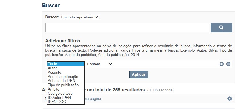
A opção Busca avançada utiliza os conectores da lógica boleana, é o melhor recurso para combinar chaves de busca e obter documentos relevantes à sua pesquisa, utilize os filtros apresentados na caixa de seleção para refinar o resultado de busca. Pode-se adicionar vários filtros a uma mesma busca.
Exemplo:
Buscar os artigos apresentados em um evento internacional de 2015, sobre loss of coolant, do autor Maprelian.
Autor: Maprelian
Título: loss of coolant
Tipo de publicação: Texto completo de evento
Ano de publicação: 2015
✔ Para indexação dos documentos é utilizado o Thesaurus do INIS, especializado na área nuclear e utilizado em todos os países membros da International Atomic Energy Agency – IAEA , por esse motivo, utilize os termos de busca de assunto em inglês; isto não exclui a busca livre por palavras, apenas o resultado pode não ser tão relevante ou pertinente.
✔ 95% do RD apresenta o texto completo do documento com livre acesso, para aqueles que apresentam o ![]() significa que e o documento está sujeito as leis de direitos autorais, solicita-se nesses casos contatar a Biblioteca do IPEN,
bibl@ipen.br
.
significa que e o documento está sujeito as leis de direitos autorais, solicita-se nesses casos contatar a Biblioteca do IPEN,
bibl@ipen.br
.
✔ Ao efetuar a busca por um autor o RD apresentará uma relação de todos os trabalhos depositados no RD. No lado direito da tela são apresentados os coautores com o número de trabalhos produzidos em conjunto bem como os assuntos abordados e os respectivos anos de publicação agrupados.
✔ O RD disponibiliza um quadro estatístico de produtividade, onde é possível visualizar o número dos trabalhos agrupados por tipo de coleção, a medida que estão sendo depositados no RD.
✔ Na página inicial nas referências são sinalizados todos os autores IPEN, ao clicar nesse símbolo ![]() será aberta uma nova página correspondente à aquele autor – trata-se da página do pesquisador.
será aberta uma nova página correspondente à aquele autor – trata-se da página do pesquisador.
✔ Na página do pesquisador, é possível verificar, as variações do nome, a relação de todos os trabalhos com texto completo bem como um quadro resumo numérico; há links para o Currículo Lattes e o Google Acadêmico ( quando esse for informado).
ATENÇÃO!
ESTE TEXTO "AJUDA" ESTÁ SUJEITO A ATUALIZAÇÕES CONSTANTES, A MEDIDA QUE NOVAS FUNCIONALIDADES E RECURSOS DE BUSCA FOREM SENDO DESENVOLVIDOS PELAS EQUIPES DA BIBLIOTECA E DA INFORMÁTICA.
O gerenciamento do Repositório está a cargo da Biblioteca do IPEN. Constam neste RI, até o presente momento 20.950 itens que tanto podem ser artigos de periódicos ou de eventos nacionais e internacionais, dissertações e teses, livros, capítulo de livros e relatórios técnicos. Para participar do RI-IPEN é necessário que pelo menos um dos autores tenha vínculo acadêmico ou funcional com o Instituto. Nesta primeira etapa de funcionamento do RI, a coleta das publicações é realizada periodicamente pela equipe da Biblioteca do IPEN, extraindo os dados das bases internacionais tais como a Web of Science, Scopus, INIS, SciElo além de verificar o Currículo Lattes. O RI-IPEN apresenta também um aspecto inovador no seu funcionamento. Por meio de metadados específicos ele está vinculado ao sistema de gerenciamento das atividades do Plano Diretor anual do IPEN (SIGEPI). Com o objetivo de fornecer dados numéricos para a elaboração dos indicadores da Produção Cientifica Institucional, disponibiliza uma tabela estatística registrando em tempo real a inserção de novos itens. Foi criado um metadado que contém um número único para cada integrante da comunidade científica do IPEN. Esse metadado se transformou em um filtro que ao ser acionado apresenta todos os trabalhos de um determinado autor independente das variáveis na forma de citação do seu nome.
A elaboração do projeto do RI do IPEN foi iniciado em novembro de 2013, colocado em operação interna em julho de 2014 e disponibilizado na Internet em junho de 2015. Utiliza o software livre Dspace, desenvolvido pelo Massachusetts Institute of Technology (MIT). Para descrição dos metadados adota o padrão Dublin Core. É compatível com o Protocolo de Arquivos Abertos (OAI) permitindo interoperabilidade com repositórios de âmbito nacional e internacional.
1. Portaria IPEN-CNEN/SP nº 387, que estabeleceu os princípios que nortearam a criação do RDI, clique aqui.
2. A experiência do Instituto de Pesquisas Energéticas e Nucleares (IPEN-CNEN/SP) na criação de um Repositório Digital Institucional – RDI, clique aqui.
O Repositório Digital do IPEN é um equipamento institucional de acesso aberto, criado com o objetivo de reunir, preservar, disponibilizar e conferir maior visibilidade à Produção Científica publicada pelo Instituto, desde sua criação em 1956.
Operando, inicialmente como uma base de dados referencial o Repositório foi disponibilizado na atual plataforma, em junho de 2015. No Repositório está disponível o acesso ao conteúdo digital de artigos de periódicos, eventos, nacionais e internacionais, livros, capítulos, dissertações, teses e relatórios técnicos.
A elaboração do projeto do RI do IPEN foi iniciado em novembro de 2013, colocado em operação interna em julho de 2014 e disponibilizado na Internet em junho de 2015. Utiliza o software livre Dspace, desenvolvido pelo Massachusetts Institute of Technology (MIT). Para descrição dos metadados adota o padrão Dublin Core. É compatível com o Protocolo de Arquivos Abertos (OAI) permitindo interoperabilidade com repositórios de âmbito nacional e internacional.
O gerenciamento do Repositório está a cargo da Biblioteca do IPEN. Constam neste RI, até o presente momento 20.950 itens que tanto podem ser artigos de periódicos ou de eventos nacionais e internacionais, dissertações e teses, livros, capítulo de livros e relatórios técnicos. Para participar do RI-IPEN é necessário que pelo menos um dos autores tenha vínculo acadêmico ou funcional com o Instituto. Nesta primeira etapa de funcionamento do RI, a coleta das publicações é realizada periodicamente pela equipe da Biblioteca do IPEN, extraindo os dados das bases internacionais tais como a Web of Science, Scopus, INIS, SciElo além de verificar o Currículo Lattes. O RI-IPEN apresenta também um aspecto inovador no seu funcionamento. Por meio de metadados específicos ele está vinculado ao sistema de gerenciamento das atividades do Plano Diretor anual do IPEN (SIGEPI). Com o objetivo de fornecer dados numéricos para a elaboração dos indicadores da Produção Cientifica Institucional, disponibiliza uma tabela estatística registrando em tempo real a inserção de novos itens. Foi criado um metadado que contém um número único para cada integrante da comunidade científica do IPEN. Esse metadado se transformou em um filtro que ao ser acionado apresenta todos os trabalhos de um determinado autor independente das variáveis na forma de citação do seu nome.