Navegação Eventos - Resumos por assunto "optical radar"
- Página inicial
- →
- IPEN
- →
- Eventos - Resumos
- →
- Navegação Eventos - Resumos por assunto
- Sobre
- Perfil Técnico
- Política de funcionamento
- Ajuda
- Apresentação
Navegação Eventos - Resumos por assunto "optical radar"
Itens para a visualização no momento 1-17 de 17
-
LANDULFO, EDUARDO
 ; LOPES, FABIO J. da S.; NAKAEMA, WALTER M.; LARROZA, ELIANE G.; ARAUJO, FELIPE V.; RODRIGUES, PATRICIA F.; RISTORI, PABLO; OTERO, LIDIA; PALLOTTA, JUAN; PAWELKO, EZEQUIEL; CHOUZA, FERNANDO; QUEL, EDUARDO; FORNO, R.; SANCHEZ, MARIA F.; CALDERON, FERNANDO; BARBOSA, HENRIQUE; GOUVEIA, DIEGO A.; ARTAXO, PAULO; MONTILLA, E.; SILVA, ANTONIETA; JIMENEZ, C.; SAAVEDRA, CALOS; HERNANDEZ, ROLANDO; ARREDONDO, RENE E.; GONZALEZ, BORIS B.; BRUNETA, CARLOS E.H.; SANCHEZ, JUAN C.A.; MARRERO, JUAN C.A.; GUSTIN, ALVARO B.; TOLEDO, DANIEL N.; BEDOYA, ANDRES; ALEGRIA, DAIRO; MUNERA, MAURICIO; WHITEMAN, DAVID. ALINE network status.
In: WORKSHOP ON LIDAR MEASUREMENTS IN LATIN AMERICA, 7th,
November 11-16, 2013,
Pucón, Chile.
Abstract...
2013.
p. 56.
; LOPES, FABIO J. da S.; NAKAEMA, WALTER M.; LARROZA, ELIANE G.; ARAUJO, FELIPE V.; RODRIGUES, PATRICIA F.; RISTORI, PABLO; OTERO, LIDIA; PALLOTTA, JUAN; PAWELKO, EZEQUIEL; CHOUZA, FERNANDO; QUEL, EDUARDO; FORNO, R.; SANCHEZ, MARIA F.; CALDERON, FERNANDO; BARBOSA, HENRIQUE; GOUVEIA, DIEGO A.; ARTAXO, PAULO; MONTILLA, E.; SILVA, ANTONIETA; JIMENEZ, C.; SAAVEDRA, CALOS; HERNANDEZ, ROLANDO; ARREDONDO, RENE E.; GONZALEZ, BORIS B.; BRUNETA, CARLOS E.H.; SANCHEZ, JUAN C.A.; MARRERO, JUAN C.A.; GUSTIN, ALVARO B.; TOLEDO, DANIEL N.; BEDOYA, ANDRES; ALEGRIA, DAIRO; MUNERA, MAURICIO; WHITEMAN, DAVID. ALINE network status.
In: WORKSHOP ON LIDAR MEASUREMENTS IN LATIN AMERICA, 7th,
November 11-16, 2013,
Pucón, Chile.
Abstract...
2013.
p. 56.
Palavras-Chave: optical radar; computer networks; aerosol monitoring; climatic change; biomass; fires; seasonal variations; volcanic regions; latin america
. ALINE network status. In: WORKSHOP ON LIDAR MEASUREMENTS IN LATIN AMERICA, 7th, November 11-16, 2013, Pucón, Chile. Abstract... 2013. p. 56. Disponível em: http://repositorio.ipen.br/handle/123456789/20253. Acesso em: $DATA.Como referenciar este itemEsta referência é gerada automaticamente de acordo com as normas do estilo IPEN/SP (ABNT NBR 6023) e recomenda-se uma verificação final e ajustes caso necessário.

-
LOROZA, ELIANE G.; CAMARGO, RICARDO de; CAMPOS, JOSE P.S.; NAKAEMA, WALTER M.; BOURAYOU, RIAD; LANDULFO, EDUARDO
; HOAREAU, CHRISTOPHE; DIONISI, DAVIDE; KECKHUT, PHILIPPE. Cirrus cloud case study over São Paulo city using lidar associated with determination of tropopause height.
In: WORKSHOP ON LIDAR MEASUREMENTS IN LATIN AMERICA, 7th,
November 11-16, 2013,
Pucón, Chile.
Abstract...
2013.
p. 47.
Palavras-Chave: brazil; atmospheres; clouds; optical radar; seasonal variations; surface air; trajectories; tropopause
. Cirrus cloud case study over São Paulo city using lidar associated with determination of tropopause height. In: WORKSHOP ON LIDAR MEASUREMENTS IN LATIN AMERICA, 7th, November 11-16, 2013, Pucón, Chile. Abstract... 2013. p. 47. Disponível em: http://repositorio.ipen.br/handle/123456789/20257. Acesso em: $DATA.Como referenciar este itemEsta referência é gerada automaticamente de acordo com as normas do estilo IPEN/SP (ABNT NBR 6023) e recomenda-se uma verificação final e ajustes caso necessário.
-
SANTOS, AMANDA V.
; LANDULFO, EDUARDO
; MOREIRA, GREGORI A.
; MARQUES, MARCIA T.A.; ANDRADE, MARIA F.. Comparing lidar and ceilometer backscattering measurements for the detection of aerosol layers in the PBL over São Paulo, Brazil.
In: WORKSHOP ON LIDAR MEASUREMENTS IN LATIN AMERICA, 11th,
October 19-22, 2021,
Punta Arenas, Chile.
Abstract...
Punta Arenas, Chile: Universidad de Magallanes,
2021.
p. 22-22.
Abstract:
The Planetary Boundary Layer (PBL) is the lowest part of the troposphere and it is directly
influenced by the Earth’s surface and anthropogenic activities. The concentration of aerosol in the PBL is
typically much higher than in the free troposphere. Given that most of the air pollution in the troposphere is
capped by this layer, obtaining the PBL height (PBLH) and its evolution during the day can assist in monitoring
and studying aerosol concentrations and properties and its impact on air quality.
Multi-instrument monitoring of the PBLH can assist in identifying the arrival of different air masses
and tracking the evolution of aerosol layers during the day. Due to their lower cost, ceilometers can be powerful
tools to enhance these measurements, although such an instrument has a few limitations when compared to
lidars. The weaker laser light source used in ceilometers can limit the detection of aerosol layers to a few
kilometers in height, depending on the presence and distribution of clouds and aerosols in the atmosphere.
Given that some methods to estimate the PBLH need strong gradients in the concentration of aerosols to identify
it correctly, the improper identification of the aerosol layers can become problematic for obtaining the PBLH.
We compared lidar and ceilometer data from two instruments located in the city of São Paulo, Brazil,
approximately 15 km from each other. We found that, in clear sky conditions, it is possible to correctly identify
aerosol layers in the PBL with data from both instruments. The presence of clouds, signal attenuation and noise
can sometimes cause errors in the identification of aerosol layers, especially when using ceilometer data. We
found that, despite not being co-located, both instruments show similar profiles, up to a few kilometers in
height.
Palavras-Chave: optical radar; boundary layers; layers; aerosols
. Comparing lidar and ceilometer backscattering measurements for the detection of aerosol layers in the PBL over São Paulo, Brazil. In: WORKSHOP ON LIDAR MEASUREMENTS IN LATIN AMERICA, 11th, October 19-22, 2021, Punta Arenas, Chile. Abstract... Punta Arenas, Chile: Universidad de Magallanes, 2021. p. 22-22. Disponível em: http://repositorio.ipen.br/handle/123456789/33306. Acesso em: $DATA.Como referenciar este itemEsta referência é gerada automaticamente de acordo com as normas do estilo IPEN/SP (ABNT NBR 6023) e recomenda-se uma verificação final e ajustes caso necessário.
-
MOREIRA, GREGORI de A.; LANDULFO, EDUARDO
; SANTIAGO, ALEXANDRE M.; SALVADOR, NADIR; LORIATO, AYRES G.; ALBUQUERQUE, TACIANA T. de A.; REIS JUNIOR, NEYVAL C.. A comparison between image methods and WRF model in determination the top of atmospheric boundary layer.
In: WORKSHOP ON LIDAR MEASUREMENTS IN LATIN AMERICA, 7th,
November 11-16, 2013,
Pucón, Chile.
Abstract...
2013.
p. 35.
Palavras-Chave: planetary atmospheres; boundary layers; forecasting; climatic change; optical radar; image processing; mathematical models; computer calculations
. A comparison between image methods and WRF model in determination the top of atmospheric boundary layer. In: WORKSHOP ON LIDAR MEASUREMENTS IN LATIN AMERICA, 7th, November 11-16, 2013, Pucón, Chile. Abstract... 2013. p. 35. Disponível em: http://repositorio.ipen.br/handle/123456789/20252. Acesso em: $DATA.Como referenciar este itemEsta referência é gerada automaticamente de acordo com as normas do estilo IPEN/SP (ABNT NBR 6023) e recomenda-se uma verificação final e ajustes caso necessário.
-
LOPES, FABIO J.S.; ANDRADE, MARIA F.; LANDULFO, EDUARDO
. Exploring the relation between Aerosol Optical Depth and ground-level particulate matter at the Metropolitan region of São Paulo - Brazil.
In: WORKSHOP ON LIDAR MEASUREMENTS IN LATIN AMERICA, 7th,
November 11-16, 2013,
Pucón, Chile.
Abstract...
2013.
p. 49.
Palavras-Chave: brazil; aerosols; air quality; climatic change; optical radar; air pollution monitors; spectrometers
. Exploring the relation between Aerosol Optical Depth and ground-level particulate matter at the Metropolitan region of São Paulo - Brazil. In: WORKSHOP ON LIDAR MEASUREMENTS IN LATIN AMERICA, 7th, November 11-16, 2013, Pucón, Chile. Abstract... 2013. p. 49. Disponível em: http://repositorio.ipen.br/handle/123456789/20256. Acesso em: $DATA.Como referenciar este itemEsta referência é gerada automaticamente de acordo com as normas do estilo IPEN/SP (ABNT NBR 6023) e recomenda-se uma verificação final e ajustes caso necessário.
-
ANTUNA-MARRERO, JUAN C.; ARREDONDO, RENE E.; LANDULFO, EDUARDO
; VEGA, ALBETH R.; SANCHEZ, JUAN C.A.. Extending LALINET observations to the Upper Troposphere and Lower Stratosphere (UTLS): a challenge in the post-COVID-19 era.
In: WORKSHOP ON LIDAR MEASUREMENTS IN LATIN AMERICA, 11th,
October 19-22, 2021,
Punta Arenas, Chile.
Abstract...
Punta Arenas, Chile: Universidad de Magallanes,
2021.
p. 36-36.
Abstract:
By the end of the XX century the lack of resources in the Latin America was not an obstacle to
create the Latin America Lidar Network (LALINET). The strategy to build LALINET was to create first a lidar
community in the region from the few lidar teams (mainly measuring in the troposphere). A little more than two
decades later LALINET resilience will be tested by the post-COVID-19 era. In Latin America the economic
crisis resulting from the COVID-19 health crisis will reduce notably funds for many activities, including
scientific research. LALINET contingency strategy (to be discussed and approved at the XI WLMLA) has as its
main goal to maintain the level of tropospheric aerosols observations and research activities reached during the
last decade. However, the contingency strategy has several other goals, including extending LALINET
observations to the UTLS making use of the existing lidar facilities. We have been setting up progressively a
program for UTLS regular measurements, making use of the existing lidar facilities. It consist in four main
steps: 1) Lidars currently retrieving tropospheric aerosols profiles will be tested for its signal to noise ratios in
the region of the UTLS to determine if its current characteristics allows retrieving aerosol backscatter profiles in
that region; 2) designing the algorithm to be used and implement the version 1 of LALINET standard
software/scripts to produce UTLS aerosol backscatter and extinction profiles; 3) implement the processing of
UTLS observations at each site having that capabilities; 4) conduct the processing of all the stored profiles at
those sites. Several studies on stratospheric aerosols conducted in the region and abroad have accumulated
know-how that is being and will be applied to the retrieval of UTLS aerosols lidar backscattering and extinction
profiles at LALINET sites. The presentations will show and discuss those studies and also describe the current
status of the four steps listed above.
Palavras-Chave: optical radar; aerosols; troposphere; stratosphere
. Extending LALINET observations to the Upper Troposphere and Lower Stratosphere (UTLS): a challenge in the post-COVID-19 era. In: WORKSHOP ON LIDAR MEASUREMENTS IN LATIN AMERICA, 11th, October 19-22, 2021, Punta Arenas, Chile. Abstract... Punta Arenas, Chile: Universidad de Magallanes, 2021. p. 36-36. Disponível em: http://repositorio.ipen.br/handle/123456789/33309. Acesso em: $DATA.Como referenciar este itemEsta referência é gerada automaticamente de acordo com as normas do estilo IPEN/SP (ABNT NBR 6023) e recomenda-se uma verificação final e ajustes caso necessário.
-
BOURAYOU, RIAD; LOPES, FABIO J. da S.; COSTA, RENATA F. da; FERRINI, PATRICIA R.; LOROZA, ELIANE G.; NAKAEMA, WALTER M.; MOREIRA, GREGORI A.; ARAUJO, FELIPE V.; POLUHA, BRUNO; LANDULFO, EDUARDO
. Fallback atmosphere models for Lidar measurements without corresponding radio-sounding data and modeling of a local atmosphere model from historic radio-sounding data. Example of the São Paulo lidar Metropolitan Station.
In: WORKSHOP ON LIDAR MEASUREMENTS IN LATIN AMERICA, 7th,
November 11-16, 2013,
Pucón, Chile.
Abstract...
2013.
p. 44.
Palavras-Chave: optical radar; atmospheres; simulation; temperature dependence; aerosols
. Fallback atmosphere models for Lidar measurements without corresponding radio-sounding data and modeling of a local atmosphere model from historic radio-sounding data. Example of the São Paulo lidar Metropolitan Station. In: WORKSHOP ON LIDAR MEASUREMENTS IN LATIN AMERICA, 7th, November 11-16, 2013, Pucón, Chile. Abstract... 2013. p. 44. Disponível em: http://repositorio.ipen.br/handle/123456789/20258. Acesso em: $DATA.Como referenciar este itemEsta referência é gerada automaticamente de acordo com as normas do estilo IPEN/SP (ABNT NBR 6023) e recomenda-se uma verificação final e ajustes caso necessário.
-
RODRIGUES, PATRICIA F.; LANDULFO, EDUARDO
; LOPES, FABIO J.S.; COSTA, RENATA F. da. First measurements of water vapor mixing ratio in São Paulo metropolitan area using a six channels Raman LIDAR.
In: WORKSHOP ON LIDAR MEASUREMENTS IN LATIN AMERICA, 7th,
November 11-16, 2013,
Pucón, Chile.
Abstract...
2013.
p. 14.
Palavras-Chave: brazil; atmospheres; water vapor; optical radar; raman spectra; mixing ratio; backscattering; wavelengths
. First measurements of water vapor mixing ratio in São Paulo metropolitan area using a six channels Raman LIDAR. In: WORKSHOP ON LIDAR MEASUREMENTS IN LATIN AMERICA, 7th, November 11-16, 2013, Pucón, Chile. Abstract... 2013. p. 14. Disponível em: http://repositorio.ipen.br/handle/123456789/20263. Acesso em: $DATA.Como referenciar este itemEsta referência é gerada automaticamente de acordo com as normas do estilo IPEN/SP (ABNT NBR 6023) e recomenda-se uma verificação final e ajustes caso necessário.
-
CARVALHO, SILVANIA A.; LOPES, FABIO J.S.
; SILVA, JONATAN J. da
; MENEGATTI, CARLOS R.; CATALANI, FERNANDO; TODERO, CARLOS J.; RIBEIRO, FABIO de J.; ALMEIDA, ROGERIO M. de; LANDULFO, EDUARDO
. LIDAR first campaign in the industrial sites of Volta Redonda-RJ and Lorena-SP, Brazil.
In: WORKSHOP ON LIDAR MEASUREMENTS IN LATIN AMERICA, 11th,
October 19-22, 2021,
Punta Arenas, Chile.
Abstract...
Punta Arenas, Chile: Universidad de Magallanes,
2021.
p. 29-29.
Abstract:
Air pollution is recognized as a risk factor for health. The emission of toxic gases and particulates,
specially with diameter size smaller than 10 μm, into the atmosphere by industries is correlated with increasing
respiratory problems, mortality and cancer in some urban areas. Additionally the aerosol particles play an
important role in the Earth’s radiation budget and the understanding of their properties is important to address
their effects on the climate and weather conditions. In this study we will present some results of aerosol vertical
distribution retrieved using a mobile lidar system and the lidar system on board of the CALIPSO satellite
platform. The synergetic use of these platforms helped to understand the impact of the aerosol suspended in the
atmosphere in terms of its optical properties in two different sites between two main metropolitan areas of
Brazil, which are São Paulo and Rio de Janeiro. In order to obtain a statistical characterization of the aerosol
optical properties, level 2-version 4 data from CALIPSO were employed to retrieve the AOD and Lidar ratio
values at 532 nm for Volta Redonda and Lorena sites. Lorena campaign was performed during a very dry period
in the 2014 Southern hemisphere winter, where it detected the vertical distribution profile with several layers
detached from the aerosol boundary layer (ABL) on 26th of June 2014. Volta Redonda-RJ campaign performed
from the beginning of November until mid of December of 2018 provided detection of aerosol layers detached
from ABL on 4th of December of 2018. We will present a brief description of the experimental apparatus, the
data taking, the methodology and the main results which open up the possibility to investigate emission of toxic
gases and particulates at this region which has high contribution to local atmospheric pollution due to the
Presidente Dutra highway (BR 116), the Companhia Siderúgica Nacional (CSN) and other metallurgical and
cement factories.
Palavras-Chave: satellites; optical radar; aerosols; urban areas
. LIDAR first campaign in the industrial sites of Volta Redonda-RJ and Lorena-SP, Brazil. In: WORKSHOP ON LIDAR MEASUREMENTS IN LATIN AMERICA, 11th, October 19-22, 2021, Punta Arenas, Chile. Abstract... Punta Arenas, Chile: Universidad de Magallanes, 2021. p. 29-29. Disponível em: http://repositorio.ipen.br/handle/123456789/33308. Acesso em: $DATA.Como referenciar este itemEsta referência é gerada automaticamente de acordo com as normas do estilo IPEN/SP (ABNT NBR 6023) e recomenda-se uma verificação final e ajustes caso necessário.
-
GUERRERO RASCADO, J.L.; LOPES, F.J.S.; LANDULFO, E.
; ALADOS ARBOLEDAS, L.. On the study of Saharan mineral dust over Latin America: the complexity of aerosol typing at São Paulo.
In: WORKSHOP ON LIDAR MEASUREMENTS IN LATIN AMERICA, 7th,
November 11-16, 2013,
Pucón, Chile.
Abstract...
2013.
p. 51.
Palavras-Chave: remote sensing; satellites; aerosols; optical radar; minerals; dusts; africa; deserts; latin america
. On the study of Saharan mineral dust over Latin America: the complexity of aerosol typing at São Paulo. In: WORKSHOP ON LIDAR MEASUREMENTS IN LATIN AMERICA, 7th, November 11-16, 2013, Pucón, Chile. Abstract... 2013. p. 51. Disponível em: http://repositorio.ipen.br/handle/123456789/20254. Acesso em: $DATA.Como referenciar este itemEsta referência é gerada automaticamente de acordo com as normas do estilo IPEN/SP (ABNT NBR 6023) e recomenda-se uma verificação final e ajustes caso necessário.
-
COSTA, RENATA F. da; BOURAYOU, RIAD; LANDULFO, EDUARDO
; STEFFENS, JULIANA; GUARDANI, ROBERTO; VESELOVSKII, IGOR. Soot extinction measurements in different heights of a petrochemical flare using lidar.
In: WORKSHOP ON LIDAR MEASUREMENTS IN LATIN AMERICA, 7th,
November 11-16, 2013,
Pucón, Chile.
Abstract...
2013.
p. 43.
Palavras-Chave: optical radar; aerosol monitoring; atmospheric chemistry; petrochemicals; backscattering; wavelengths
. Soot extinction measurements in different heights of a petrochemical flare using lidar. In: WORKSHOP ON LIDAR MEASUREMENTS IN LATIN AMERICA, 7th, November 11-16, 2013, Pucón, Chile. Abstract... 2013. p. 43. Disponível em: http://repositorio.ipen.br/handle/123456789/20259. Acesso em: $DATA.Como referenciar este itemEsta referência é gerada automaticamente de acordo com as normas do estilo IPEN/SP (ABNT NBR 6023) e recomenda-se uma verificação final e ajustes caso necessário.
-
LOPES, PEROLA P.Q.
; LOPES, FABIO J.S.
; LANDULFO, EDUARDO
. Study between atmospheric paramenters and pyranometer global radiation measurements at São Paulo, Brazil.
In: WORKSHOP ON LIDAR MEASUREMENTS IN LATIN AMERICA, 11th,
October 19-22, 2021,
Punta Arenas, Chile.
Abstract...
Punta Arenas, Chile: Universidad de Magallanes,
2021.
p. 19-19.
Abstract:
According to the recently released report of the Intergovernmental Panel on Climate Change
(IPCC) on August of 2021, the well-mixed greenhouse gas (GHG) concentrations have continued to increase in
the atmosphere, reaching annual averages of 410 ppm for CO2,1866 ppb for CH4, and 332 ppb for N2O. The
GHGs can contribute to warming the atmosphere up to 2.0°C, while aerosols can contribute to cooling up to
0.8°C. in this context, it is increasingly important to monitor the global solar radiation flux incident on the
atmosphere. The pyranometer instrument is designed to measure the solar radiation flux density (W/m2) and it
can be used to get information about the amount of radiation incident on the ground and how much of this
radiation is absorbed or scattered. The aim of this work is to show preliminary results retrieved by Piranometer
installed in the SPU Lidar Station, in São Paulo-Brazil, and how the global solar radiation can be correlated with
other atmospheric parameters retrieved from AERONET sunphotometer and meteorologic stations, such as the
aerosol optical depth (AOD), cloud cover, relative humidity, in order to quantify the aerosol influence in the
process of atmospheric radiation and climate change.
Palavras-Chave: solar radiation; radiometers; optical radar; clouds
. Study between atmospheric paramenters and pyranometer global radiation measurements at São Paulo, Brazil. In: WORKSHOP ON LIDAR MEASUREMENTS IN LATIN AMERICA, 11th, October 19-22, 2021, Punta Arenas, Chile. Abstract... Punta Arenas, Chile: Universidad de Magallanes, 2021. p. 19-19. Disponível em: http://repositorio.ipen.br/handle/123456789/33304. Acesso em: $DATA.Como referenciar este itemEsta referência é gerada automaticamente de acordo com as normas do estilo IPEN/SP (ABNT NBR 6023) e recomenda-se uma verificação final e ajustes caso necessário.
-
ARAUJO, FELIPE V.; LANDULFO, EDUARDO
; NAKAEMA, WALTER M.; LOPES, FABIO J.S.. Study of long-range transportation of biomass burning event during the winter of 2010 in the Metropolitan region of São Paulo - Brazil using Lidar. AERONET and CALIPSO satellite.
In: WORKSHOP ON LIDAR MEASUREMENTS IN LATIN AMERICA, 7th,
November 11-16, 2013,
Pucón, Chile.
Abstract...
2013.
p. 50.
Palavras-Chave: brazil; aerosol monitoring; biomass; fires; environmental effects; pollution; seasonal variations; optical radar; satellites; c codes
. Study of long-range transportation of biomass burning event during the winter of 2010 in the Metropolitan region of São Paulo - Brazil using Lidar. AERONET and CALIPSO satellite. In: WORKSHOP ON LIDAR MEASUREMENTS IN LATIN AMERICA, 7th, November 11-16, 2013, Pucón, Chile. Abstract... 2013. p. 50. Disponível em: http://repositorio.ipen.br/handle/123456789/20255. Acesso em: $DATA.Como referenciar este itemEsta referência é gerada automaticamente de acordo com as normas do estilo IPEN/SP (ABNT NBR 6023) e recomenda-se uma verificação final e ajustes caso necessário.
-
SOUZA, GIOVANNI
; LOPES, FABIO J.S.
; LANDULFO, EDUARDO
. Study of optical properties and spatial distribution of cirrus clouds over São Paulo, Brazil, using CALIPSO level 2 data.
In: WORKSHOP ON LIDAR MEASUREMENTS IN LATIN AMERICA, 11th,
October 19-22, 2021,
Punta Arenas, Chile.
Abstract...
Punta Arenas, Chile: Universidad de Magallanes,
2021.
p. 67-67.
Abstract:
Cirrus clouds have an important role in the earth’s radiation budget, they have a wide spatial
extension and are the most present type of clouds in the atmosphere, especially in tropical regions (Sassen et al.,
2018). Due their thickness, Cirrus clouds are almost transparent for the incoming shortwave solar radiation and
opaque to the longwave emitted by the planet's surface. Despite the importance of Cirrus clouds in the earth’s
climate, there is a lack of studies focused on this type of cloud in the southern hemisphere. Since 2006, the
Cloud-Aerosol Lidar and Infrared Pathfinder Satellite Observation (CALIPSO), a joint mission between NASA
and the French space agency, CNES, provides physical and optical information of clouds and aerosols to
improve the understanding of their role in the climate, air quality and radiation budget in the Earth. The primary
instrument of CALIPSO payload is the Cloud-Aerosol Lidar with Orthogonal Polarization (CALIOP), which is
a lidar system operating on 1064 nm and 532 nm (with parallel and perpendicular polarization) wavelengths.
CALIOP provides as level 1 data, high-resolution vertical profiles of aerosols and clouds. In turn, the level 2
data provides processed products such as cloud-aersol discrimination, cloud base and top layer altitude, and
cloud optical depth. The aim of this work is use the CALIOP global coverage to study the physical and optical
properties of Cirrus clouds over the São Paulo State (roughly centered on 21.3°S, 50.3°W), in Brazil. We have
employed a statistic analysis of 9 years (2007-2015) of data using the level 2 products to obtain spatial
distribution and optical properties of cirrus clouds over São Paulo state, in order to understanding the long-term
trend of Cirrus clouds coverage in the São Paulo state and later on Brazil.
Palavras-Chave: optical radar; clouds; satellites; earth atmosphere; solar radiation
. Study of optical properties and spatial distribution of cirrus clouds over São Paulo, Brazil, using CALIPSO level 2 data. In: WORKSHOP ON LIDAR MEASUREMENTS IN LATIN AMERICA, 11th, October 19-22, 2021, Punta Arenas, Chile. Abstract... Punta Arenas, Chile: Universidad de Magallanes, 2021. p. 67-67. Disponível em: http://repositorio.ipen.br/handle/123456789/33313. Acesso em: $DATA.Como referenciar este itemEsta referência é gerada automaticamente de acordo com as normas do estilo IPEN/SP (ABNT NBR 6023) e recomenda-se uma verificação final e ajustes caso necessário.
-
BARBOSA, H.H.J.; GOUVEIA, D.A.; LANDULFO, E.
; LOPES, F.J.S.; RISTORI, P.; FORNO, R.; MONTILLA, E.; SILVA, A.
; JIMENEZ, C.; ARREDONDO, R.E.; MARIANO, G.L.. The first ALINE measurements and intercomparison exercise on lidar inversion algorithms.
In: WORKSHOP ON LIDAR MEASUREMENTS IN LATIN AMERICA, 7th,
November 11-16, 2013,
Pucón, Chile.
Abstract...
2013.
p. 24.
Palavras-Chave: optical radar; aerosol monitoring; computer networks; data acquisition; air quality; forecasting; biomass; quality assurance; comparative evaluations
. The first ALINE measurements and intercomparison exercise on lidar inversion algorithms. In: WORKSHOP ON LIDAR MEASUREMENTS IN LATIN AMERICA, 7th, November 11-16, 2013, Pucón, Chile. Abstract... 2013. p. 24. Disponível em: http://repositorio.ipen.br/handle/123456789/20261. Acesso em: $DATA.Como referenciar este itemEsta referência é gerada automaticamente de acordo com as normas do estilo IPEN/SP (ABNT NBR 6023) e recomenda-se uma verificação final e ajustes caso necessário.
-
LOPES, FABIO
; YOSHIDA, ALEXANDRE
; CACHEFFO, ALEXANDRE
; SILVA, JONATAN
; MOREIRA, GREGORI
; LANDULFO, EDUARDO
. Validation of AEOLUS L2A products using a multiwavelength lidar system at SPU Lidar Station - Brazil.
In: AEOLUS CAL/VAL AND SCIENCE WORKSHOP,
November 2-6, 2020,
Online.
Apresentação...
2020.
Palavras-Chave: optical radar; aerosols; layers; earth atmosphere; wave propagation; satellite atmospheres
. Validation of AEOLUS L2A products using a multiwavelength lidar system at SPU Lidar Station - Brazil. In: AEOLUS CAL/VAL AND SCIENCE WORKSHOP, November 2-6, 2020, Online. Apresentação... 2020. Disponível em: http://repositorio.ipen.br/handle/123456789/32196. Acesso em: $DATA.Como referenciar este itemEsta referência é gerada automaticamente de acordo com as normas do estilo IPEN/SP (ABNT NBR 6023) e recomenda-se uma verificação final e ajustes caso necessário.
-
MARQUES, M.T.A.; LANDULFO, EDUARDO
. Wind doppler lidar analysis of a complex terrain in Northeastern Brazil for wind energy purposes.
In: WORKSHOP ON LIDAR MEASUREMENTS IN LATIN AMERICA, 7th,
November 11-16, 2013,
Pucón, Chile.
Abstract...
2013.
p. 41.
Palavras-Chave: optical radar; remote sensing; wind; doppler effect; wind power
. Wind doppler lidar analysis of a complex terrain in Northeastern Brazil for wind energy purposes. In: WORKSHOP ON LIDAR MEASUREMENTS IN LATIN AMERICA, 7th, November 11-16, 2013, Pucón, Chile. Abstract... 2013. p. 41. Disponível em: http://repositorio.ipen.br/handle/123456789/20260. Acesso em: $DATA.Como referenciar este itemEsta referência é gerada automaticamente de acordo com as normas do estilo IPEN/SP (ABNT NBR 6023) e recomenda-se uma verificação final e ajustes caso necessário.
Itens para a visualização no momento 1-17 de 17
Buscar no repositório
Navegar
Minha conta
Visualizar
A pesquisa no RD utiliza os recursos de busca da maioria das bases de dados. No entanto algumas dicas podem auxiliar para obter um resultado mais pertinente.
✔ É possível efetuar a busca de um autor ou um termo em todo o RD, por meio do Buscar no Repositório , isto é, o termo solicitado será localizado em qualquer campo do RD. No entanto esse tipo de pesquisa não é recomendada a não ser que se deseje um resultado amplo e generalizado.
✔ A pesquisa apresentará melhor resultado selecionando um dos filtros disponíveis em Navegar
✔ Os filtros disponíveis em Navegar tais como: Coleções, Ano de publicação, Títulos, Assuntos, Autores, Revista, Tipo de publicação são autoexplicativos. O filtro, Autores IPEN apresenta uma relação com os autores vinculados ao IPEN; o ID Autor IPEN diz respeito ao número único de identificação de cada autor constante no RD e sob o qual estão agrupados todos os seus trabalhos independente das variáveis do seu nome; Tipo de acesso diz respeito à acessibilidade do documento, isto é , sujeito as leis de direitos autorais, ID RT apresenta a relação dos relatórios técnicos, restritos para consulta das comunidades indicadas.
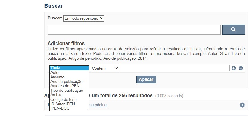
A opção Busca avançada utiliza os conectores da lógica boleana, é o melhor recurso para combinar chaves de busca e obter documentos relevantes à sua pesquisa, utilize os filtros apresentados na caixa de seleção para refinar o resultado de busca. Pode-se adicionar vários filtros a uma mesma busca.
Exemplo:
Buscar os artigos apresentados em um evento internacional de 2015, sobre loss of coolant, do autor Maprelian.
Autor: Maprelian
Título: loss of coolant
Tipo de publicação: Texto completo de evento
Ano de publicação: 2015
✔ Para indexação dos documentos é utilizado o Thesaurus do INIS, especializado na área nuclear e utilizado em todos os países membros da International Atomic Energy Agency – IAEA , por esse motivo, utilize os termos de busca de assunto em inglês; isto não exclui a busca livre por palavras, apenas o resultado pode não ser tão relevante ou pertinente.
✔ 95% do RD apresenta o texto completo do documento com livre acesso, para aqueles que apresentam o ![]() significa que e o documento está sujeito as leis de direitos autorais, solicita-se nesses casos contatar a Biblioteca do IPEN,
bibl@ipen.br
.
significa que e o documento está sujeito as leis de direitos autorais, solicita-se nesses casos contatar a Biblioteca do IPEN,
bibl@ipen.br
.
✔ Ao efetuar a busca por um autor o RD apresentará uma relação de todos os trabalhos depositados no RD. No lado direito da tela são apresentados os coautores com o número de trabalhos produzidos em conjunto bem como os assuntos abordados e os respectivos anos de publicação agrupados.
✔ O RD disponibiliza um quadro estatístico de produtividade, onde é possível visualizar o número dos trabalhos agrupados por tipo de coleção, a medida que estão sendo depositados no RD.
✔ Na página inicial nas referências são sinalizados todos os autores IPEN, ao clicar nesse símbolo ![]() será aberta uma nova página correspondente à aquele autor – trata-se da página do pesquisador.
será aberta uma nova página correspondente à aquele autor – trata-se da página do pesquisador.
✔ Na página do pesquisador, é possível verificar, as variações do nome, a relação de todos os trabalhos com texto completo bem como um quadro resumo numérico; há links para o Currículo Lattes e o Google Acadêmico ( quando esse for informado).
ATENÇÃO!
ESTE TEXTO "AJUDA" ESTÁ SUJEITO A ATUALIZAÇÕES CONSTANTES, A MEDIDA QUE NOVAS FUNCIONALIDADES E RECURSOS DE BUSCA FOREM SENDO DESENVOLVIDOS PELAS EQUIPES DA BIBLIOTECA E DA INFORMÁTICA.
O gerenciamento do Repositório está a cargo da Biblioteca do IPEN. Constam neste RI, até o presente momento 20.950 itens que tanto podem ser artigos de periódicos ou de eventos nacionais e internacionais, dissertações e teses, livros, capítulo de livros e relatórios técnicos. Para participar do RI-IPEN é necessário que pelo menos um dos autores tenha vínculo acadêmico ou funcional com o Instituto. Nesta primeira etapa de funcionamento do RI, a coleta das publicações é realizada periodicamente pela equipe da Biblioteca do IPEN, extraindo os dados das bases internacionais tais como a Web of Science, Scopus, INIS, SciElo além de verificar o Currículo Lattes. O RI-IPEN apresenta também um aspecto inovador no seu funcionamento. Por meio de metadados específicos ele está vinculado ao sistema de gerenciamento das atividades do Plano Diretor anual do IPEN (SIGEPI). Com o objetivo de fornecer dados numéricos para a elaboração dos indicadores da Produção Cientifica Institucional, disponibiliza uma tabela estatística registrando em tempo real a inserção de novos itens. Foi criado um metadado que contém um número único para cada integrante da comunidade científica do IPEN. Esse metadado se transformou em um filtro que ao ser acionado apresenta todos os trabalhos de um determinado autor independente das variáveis na forma de citação do seu nome.
A elaboração do projeto do RI do IPEN foi iniciado em novembro de 2013, colocado em operação interna em julho de 2014 e disponibilizado na Internet em junho de 2015. Utiliza o software livre Dspace, desenvolvido pelo Massachusetts Institute of Technology (MIT). Para descrição dos metadados adota o padrão Dublin Core. É compatível com o Protocolo de Arquivos Abertos (OAI) permitindo interoperabilidade com repositórios de âmbito nacional e internacional.
1. Portaria IPEN-CNEN/SP nº 387, que estabeleceu os princípios que nortearam a criação do RDI, clique aqui.
2. A experiência do Instituto de Pesquisas Energéticas e Nucleares (IPEN-CNEN/SP) na criação de um Repositório Digital Institucional – RDI, clique aqui.
O Repositório Digital do IPEN é um equipamento institucional de acesso aberto, criado com o objetivo de reunir, preservar, disponibilizar e conferir maior visibilidade à Produção Científica publicada pelo Instituto, desde sua criação em 1956.
Operando, inicialmente como uma base de dados referencial o Repositório foi disponibilizado na atual plataforma, em junho de 2015. No Repositório está disponível o acesso ao conteúdo digital de artigos de periódicos, eventos, nacionais e internacionais, livros, capítulos, dissertações, teses e relatórios técnicos.
A elaboração do projeto do RI do IPEN foi iniciado em novembro de 2013, colocado em operação interna em julho de 2014 e disponibilizado na Internet em junho de 2015. Utiliza o software livre Dspace, desenvolvido pelo Massachusetts Institute of Technology (MIT). Para descrição dos metadados adota o padrão Dublin Core. É compatível com o Protocolo de Arquivos Abertos (OAI) permitindo interoperabilidade com repositórios de âmbito nacional e internacional.
O gerenciamento do Repositório está a cargo da Biblioteca do IPEN. Constam neste RI, até o presente momento 20.950 itens que tanto podem ser artigos de periódicos ou de eventos nacionais e internacionais, dissertações e teses, livros, capítulo de livros e relatórios técnicos. Para participar do RI-IPEN é necessário que pelo menos um dos autores tenha vínculo acadêmico ou funcional com o Instituto. Nesta primeira etapa de funcionamento do RI, a coleta das publicações é realizada periodicamente pela equipe da Biblioteca do IPEN, extraindo os dados das bases internacionais tais como a Web of Science, Scopus, INIS, SciElo além de verificar o Currículo Lattes. O RI-IPEN apresenta também um aspecto inovador no seu funcionamento. Por meio de metadados específicos ele está vinculado ao sistema de gerenciamento das atividades do Plano Diretor anual do IPEN (SIGEPI). Com o objetivo de fornecer dados numéricos para a elaboração dos indicadores da Produção Cientifica Institucional, disponibiliza uma tabela estatística registrando em tempo real a inserção de novos itens. Foi criado um metadado que contém um número único para cada integrante da comunidade científica do IPEN. Esse metadado se transformou em um filtro que ao ser acionado apresenta todos os trabalhos de um determinado autor independente das variáveis na forma de citação do seu nome.